Travel Guide Hveragerði
Find an accommodation
Advertising
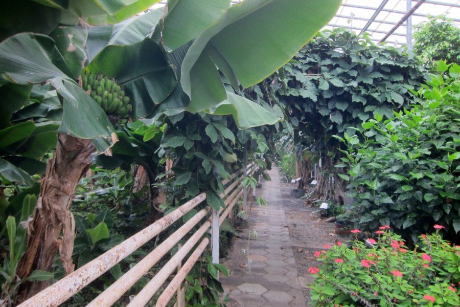
Small town of 2,316 inhabitants, located in an area of intense geothermal activity, at the southern end of the volcanic zone of the Reykjanes peninsula (an area that continues along the Þingvellir fault to the Langjökull glacier). The harnessing of geothermal energy has made it possible to develop greenhouse cultivation, heated by hot water vapours. If you've ever played Trivial Pursuit, you may have heard the question: "Which is the biggest producer of bananas in Europe? The answer was "Iceland", thanks to its greenhouses (although this is probably no longer the case).This volcanic area is the visible face of the ridge that runs through the middle of the Atlantic Ocean. The many hot springs are a reminder of the telluric forces at work beneath our feet. Another line of volcanic activity stretches across Iceland, between the Vestmann islands in the south, across the Vatnajökull glacier and as far north as the Öxarfjörður fjord.The hot springs at Hveragerði, fed by the Hengill volcano, are closely linked to continental drift. In areas of volcanic activity, magma forms pockets deep underground or erupts to the surface. It is these underground pockets that are the source of geothermal phenomena (geysers, solfataras, hot springs and bubbling mud pots).
What to visit Hveragerði?


Weather at the moment
Advertising
Organize your trip with our partners Hveragerði
Transportation
Book your plane tickets
Car Rental
Boat rental
Accommodation & stays
Find a hotel
Holiday rental
Find your campsite
Tailor-made trip
Immersion travel
Services / On site
Activities & visits
Find a doctor
Hveragerði travel inspiration


Find unique Stay Offers with our Partners


Other destinations nearby Hveragerði
25 km away