Travel Guide Bandrélé
Find an accommodation
Advertising
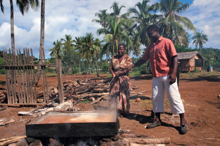
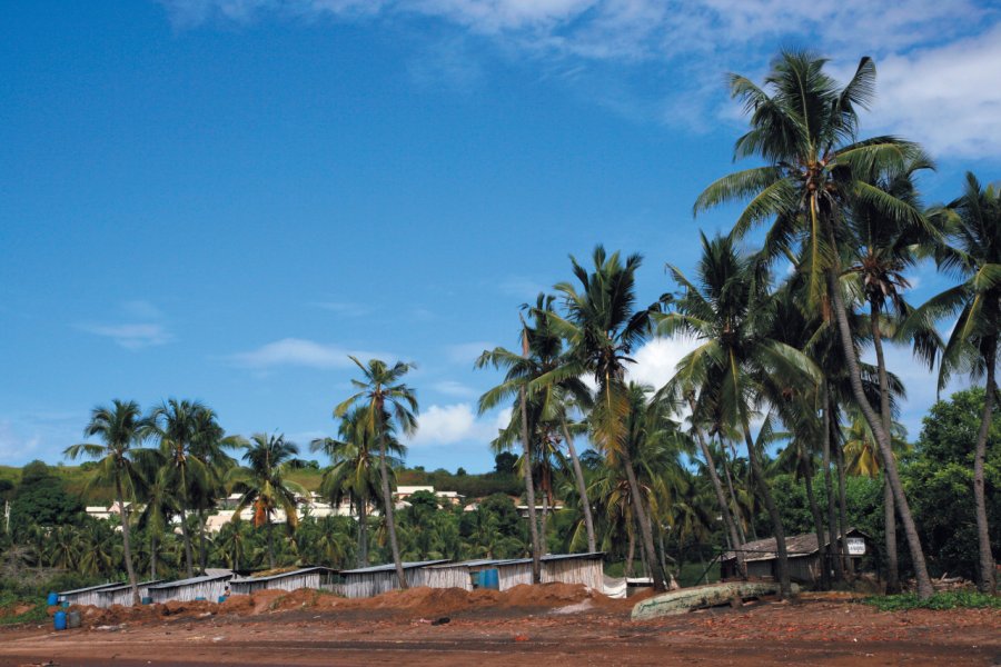
Bandrélé comes from the word bandra which means "flat" in mahorais, for proof go and have a look at the topography in front of the SNIE. The big town of Bandrélé (10 282 inhabitants) is reached with the salt eco-museum which is located in the direction of the soccer field. You will be able to discover there the shingos mamas who transmit an ancestral knowledge from mother to daughter and who obtain, from the mud of the mangrove, a beautiful salt, or shingo, all white thanks to a process of evaporation. The town has developed a lot and has modern facilities, clothing stores and a very good restaurant. From there, two important hiking trails lead up to Mount Benara (660 m), the highest point of the island. This one offers a superb panorama on the bay of Bouéni, the mount Choungui, the point Sazilé. Further on, you can reach the famous Musical Plage beach, very popular with the Mahorais at weekends for giant voulés. One of the biggest baobabs of the island is one of the curiosities of the place! It is said to be at least 600 years old and has a circumference of more than 28 meters... This pretty dark sandy beach faces the Bambo islet and allows you to observe, at low tide, on your right in extension of the tip of Sazilé, the now famous islet of Sable-Blanc, accessible only by boat.
What to visit Bandrélé?


Weather at the moment
Advertising
Organize your trip with our partners Bandrélé
Transportation
Book your plane tickets
Car Rental
Boat rental
Accommodation & stays
Find a hotel
Holiday rental
Find your campsite
Tailor-made trip
Immersion travel
Services / On site
Activities & visits
Find a doctor
Bandrélé travel inspiration


Find unique Stay Offers with our Partners


Other destinations nearby Bandrélé
25 km away