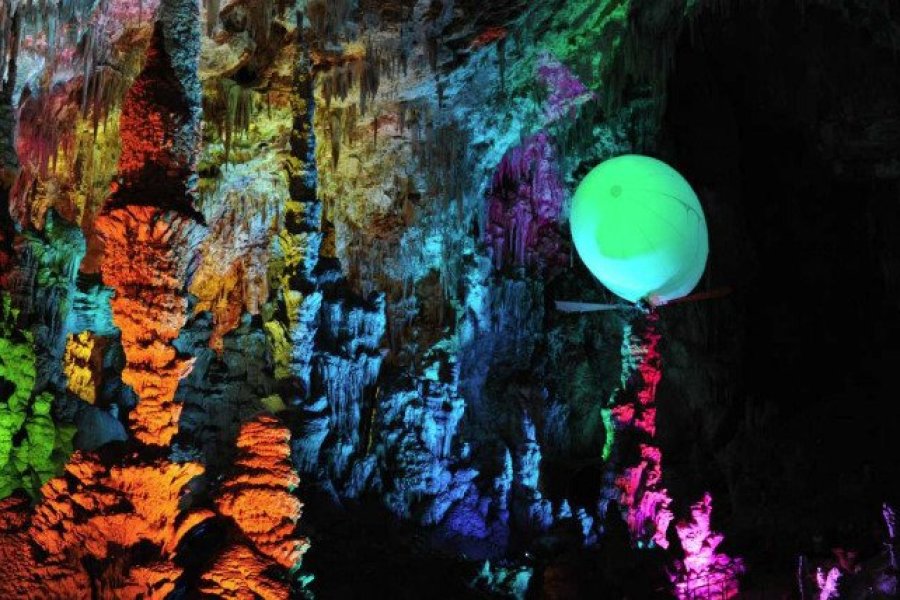
Situated near the Seuil de Naurouze, the water divide between the Atlantic and the Mediterranean, the village of Montferrand occupies the summit and slopes of a hill used in the Middle Ages for its defensive value. The highest point has an orientation table that directs the view towards the Montagne Noire, the Lauragais plain and, further south, the Pyrenees. Below, the main road follows the route of the ancient Voie d'Aquitaine, which in Roman times served a veritable agglomeration covering some 15 hectares, cited as Elusiodunum as early as the 1st century BC. A Christian place of worship and a necropolis were built on the site from the5th to the 8th century. This burial site was the subject of archaeological excavations in the 1950s and further research in the 2000s. The remains of a basilica with sarcophagi are still visible. Not far away, another church probably appeared in Carolingian times, known as Saint-Pierre d'Alzonne. It has survived to the present day, and its cemetery is still in use. The entrance to the church houses a small collection of discoidal stelae (ancient medieval grave markers). The fortified village, castrum de Montferrand, was probably built in the 12th century and became a stronghold in the early 13th century during the Crusade against the Albigensians. The site of the former castle was transformed, and a medieval gate tower, still visible today, bears witness to this late medieval transformation.

What to visit Montferrand?

Weather at the moment

Loading...
Organize your trip with our partners Montferrand
Transportation
Accommodation & stays
Services / On site

Pictures and images Montferrand

There are currently no photos for this destination.

Find unique Stay Offers with our Partners

Send a reply