Travel Guide Mount Longonot National Park
Find an accommodation
Advertising
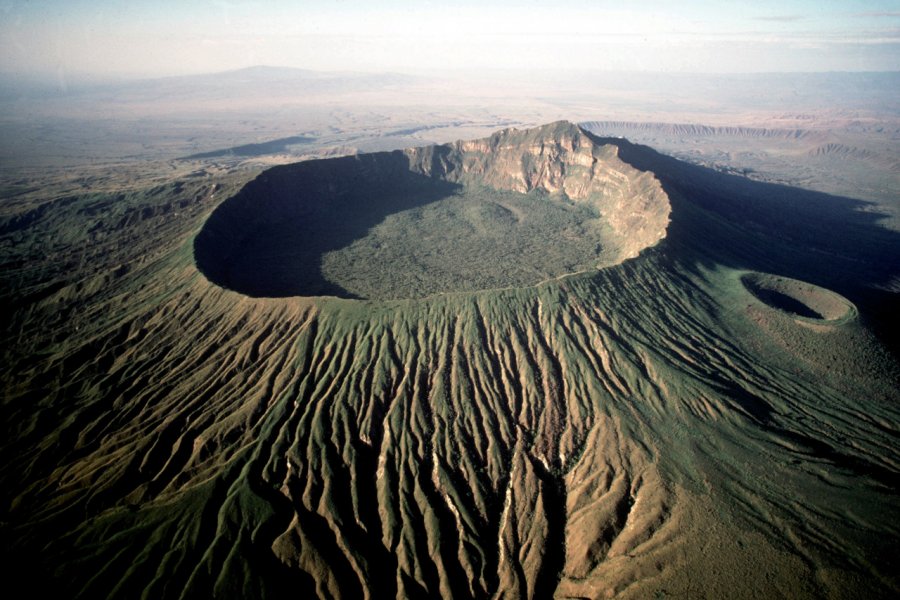
Hiking enthusiasts should not miss the ascent of Mount Longonot. This young volcano (barely a million years old!), which rises to an altitude of 2,776 m, is perfectly visible from the old Naivasha-Nairobi road. Located a few kilometers south of Naivasha and 80 kilometers northwest of Nairobi, Mount Longonot is a stratovolcano (or composite volcano), crowned by a caldera (circular depression) 8 km wide and 12 km long. It last erupted around 1863. The ascent to the crater ridge requires a short hour's walk, it is a bit steep, but not really difficult (good shoes, water and hat are nevertheless essential). It is then necessary to count between two and three hours (if one wishes to take its time) to make the turn of the crater. The panorama offered is simply grandiose: you dominate the whole Rift Valley. You will also discover a unique flora. It is not uncommon to come across zebras and antelopes. A small and rather perilous path allows you to descend to the bottom of the crater, which offers however a rather limited interest. To reach the trailhead, you have to go to the Longonot station located along the old Naivasha-Nairobi road (about 65 km from Naivasha). A small parking lot and a ranger station are waiting for you. The advantage is that a ranger will be your guide (you can give him what you want). If you can, don't hesitate because this is one of the most beautiful hikes in Kenya
Suggested addresses Mount Longonot National Park
Weather at the moment
Advertising
Organize your trip with our partners Mount Longonot National Park
Transportation
Book your plane tickets
Car Rental
Boat rental
Accommodation & stays
Find a hotel
Holiday rental
Find your campsite
Tailor-made trip
Immersion travel
Services / On site
Activities & visits
Find a doctor