Travel Guide Parque Nacional Volcán Irazú
Find an accommodation
Advertising
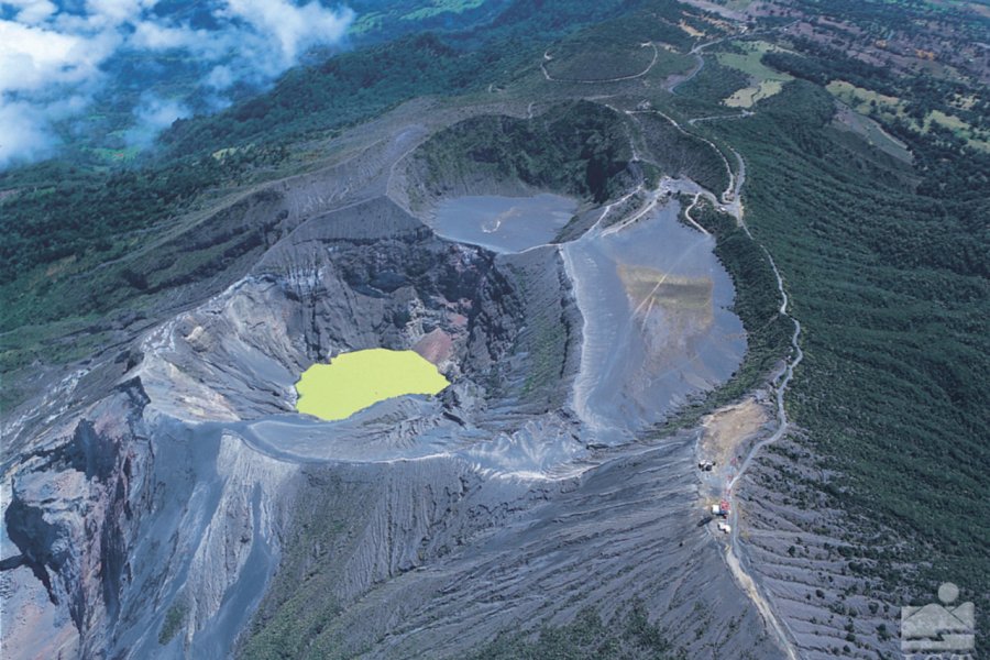
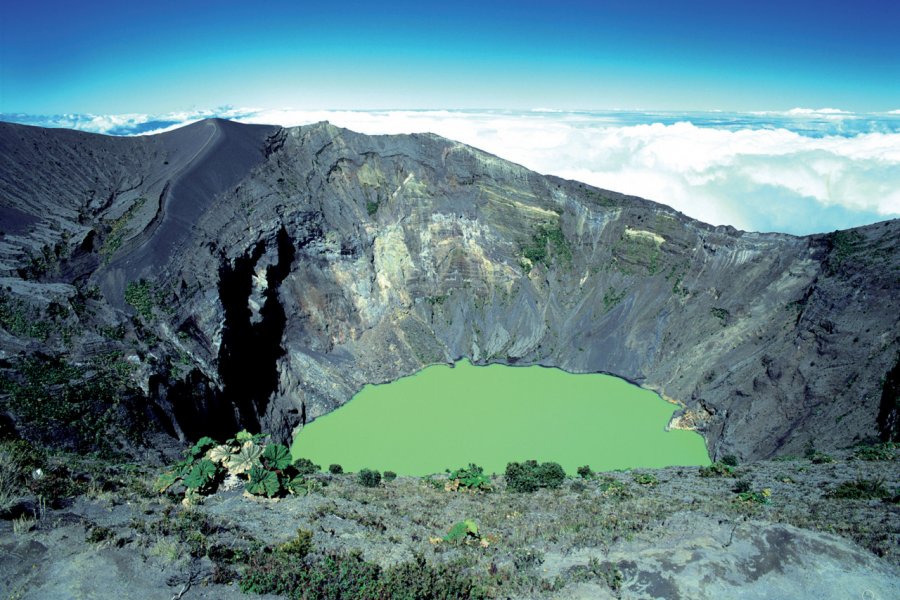
At 31 km northwest of Cartago, Irazú, which culminates at 3,432 m of altitude, is an active volcano with a heavy eruptive past. Its eruptions are accompanied by clouds of steam and heavy jets of ash, slag or stones of varying sizes. The earth trembles and emits muffled rumblings. The first known eruption dates back to 1723 and the last one, in 1963, started the same day that President Kennedy came to visit Costa Rica! Then, the inhabitants of the region had to protect themselves during two years from the ashes vomited by the volcano. Its last outbursts were in 1991 and 1994, when a part of the mountain collapsed towards the Sucio river. Only a few fumaroles are currently visible, but it is necessary to be able to differentiate them from the ashes swept by the wind. At the top of Irazú, there are five craters: the main one, Diego de la Haya, has a lunar landscape over 1,050 m in diameter; the second one housed a sulfurous lake; and the others, of lesser importance, are located on either side of the main crater. In 2017, the green lagoon of Diego de la Haya that we see in all the photos had disappeared and this abruptly, with the surges of the volcano Turrialba the water had evaporated... However, during 2018, the lagoon was reformed for the greatest happiness of all and it again wears its pretty dress color emerald.
Suggested addresses Parque Nacional Volcán Irazú
Weather at the moment
Advertising
Organize your trip with our partners Parque Nacional Volcán Irazú
Transportation
Book your plane tickets
Car Rental
Boat rental
Accommodation & stays
Find a hotel
Holiday rental
Find your campsite
Tailor-made trip
Immersion travel
Services / On site
Activities & visits
Find a doctor
Parque Nacional Volcán Irazú travel inspiration

Find unique Stay Offers with our Partners


Other destinations nearby Parque Nacional Volcán Irazú
25 km away