PORT-CROS HIKING

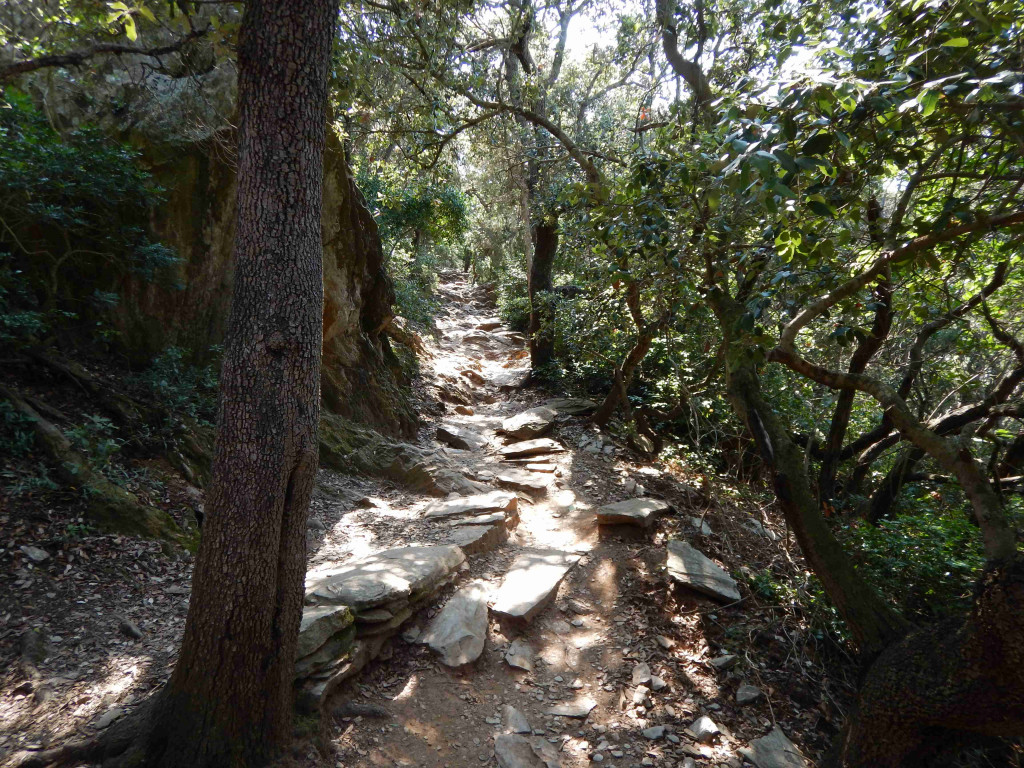
7 m ², 4,5 km long for 2 km wide, 3 beaches… And 30 kilometres of marked footpaths! Den de la nature, Port Cros also proves to be a paradise for hikers. As a national Park, bicycles are banned. With water and good walking shoes, the discovery of the steep sea lanes and the forest areas of the heart of the island is a real pleasure. A few brochures (fees) are available at the Parc du Parc as soon as you walk from the boat, but all the paths leading to Rome, it is impossible to get lost on Port Cros. The few circuits that we recommend are only suggestions and are only a non-exhaustive list: follow your instinct and your desires, you will discover many treasures! There are some basic rules to be respected, such as the strict smoking ban; finally, a day of great mistral, certain areas of the island are closed: before committing yourself, please visit the website of the Var prefecture, "Forest mass", or at the Parc du Parc if you are already on site.
The circuit of the peaks. A loop of about 3 hours, it is one of the main routes of Port Cros, combining with brilliantly forested forest, grandiose panorama and discovery of the island fauna. From the landing, go along the harbour to the South Beach: once at the bottom of the bay, turn left at the foot of the stairs. Step by step, according to the different stages of the dam, the Vallon de la Solitude - one of the three main valleys of the island, and perhaps the most poetic - the peaks, Mont Vinegar and its 194 meters altitude, the Pointe du Cognet, the South Beach and the False-Mint, the small inhabitants of the island are revealed with the Dévoilent. more or less timidity. By opening the eye, and showing a little patience for some species, we can see here a spider épeire fasciée, there a Hermann turtle, later a Jason butterfly, a Sardinian discoglosse (endemic frog-like amphibian), an Egyptian locust, a cigale (much easier to hear than sight!), a snake at a level or a Montpellier (harmless for man), and even stretch your ear to hear at sunset, a little owl from the side of the dam. Along the peaks and top of Mont Vinegar, Mediterranean shearwaters, swifts, peregrine falcons, and other ovenbirds pitchou you book a show of high flying. Other animal species, finally, will only arrive at night at night, like the scorpion black-tailed black (not aggressive and whose piqure is not more painful than the wasp), the phyllodactyle, (small herd gecko), and the bat.
The Port-Man circuit and the plant trail. A 4-hour loop from the dock, the Port-Man circuit begins with the plant trail, a route of 1 h 30 round-trip linking the village to the beach of Palud, allowing to discover the Mediterranean flora through a coastline offering beautiful views. Passionnés of flora, we recommend before you get the brochure "Plant trail" at the Maison du Parc (1,50 €): it will prove useful in deciphering the numbered plates marked throughout this first part. From the landing, go to the Post office, take the first runway on the left, and logically follow the signs "plant trail". From Fort du Moulin to Fort de Port-Man (count approximately 1 h 30), follow the point of the Miladou and its point of view on the rock of the Rascas, the Beach of La Palud (final point of the plant trail), the tip of the Galley and its panorama on the long sand, then the beach of Port-Man. In normal time, the loop ends with the massif through the ruins of the Sardine, the pass of the Four paths and the road of the forts; in the event of fire danger, a half-turn will have to be made.
The Writers'Trail. 3-hour loop in the centre of the island, the writers'trail is not yet marked as such: during our 2016 survey, its markup was still in project. On the other hand, it is well mentioned on the map of the island - sold at the Parc du Parc (3 €) or downloaded via a QR Code -, so that one can commit to it in one direction and in the other, through trails on trails. At the beginning of the village, one can, for example, start walking along the port - small hook by the chapel - and then bifurquant at the Manoir to take the direction of the dam and the Vallon de la Solitude: this first part is common to the circuit of the peaks. After crossing the island in its width, and admired the marine point of view from its end, turn left into the direction of the Fortin of the Watch, the summer district of the NRF in the 1920 s and 1930 s, then continue towards the ruins of the Sardine. Some sips of water, and take over the direction of the village by the pass of the Four paths and by the road of the forts (fort of the Eminence, fort of the Estissac and fort of the Moulin will reveal all in turn): the latter part is common at the end of the Port-Man circuit.
The Vallon de la Solitude. A beautiful, easy loop near the village, which lasts only one hour and leads to dazzling vestiges of the past. From the landing, passing through the harbour to the chapel and the communal well, pass the Solitude Creek and the marshy fringe planted with tamarisks and cannes de Provence, then turn left at the statue of Saint Joseph: you are at the edge of the Port Cros. Soon, you will come to a white mulberry: it is one of the 300 specimens planted in the Plaine du Manoir in the second half of the th century. At the time when the island is experiencing intense agricultural development, it is food for silk worms. By continuing your path, you will reach the quarry of shale, the ruins of the old factory of pipes and "cause" (shale tile used for the construction of houses), the house for cows (converted later in chèvrerie), then the dam. Outline the latter, and take over the direction of the village by passing the restanques: these dry stone walls used to support the terraces on which vines and olive trees were cultivated. Soon in the village, the cemetery is your penultimate stop, before finishing at the fort of the Moulin, and down to the right port.
Did you know? This review was written by our professional authors.
Book the Best Activities with Get Your Guide
Members' reviews on PORT-CROS HIKING
The ratings and reviews below reflect the subjective opinions of members and not the opinion of The Little Witty.
Find unique holiday offers with our partners