Travel Guide Udzungwa Mountains National Park
Find an accommodation
Advertising
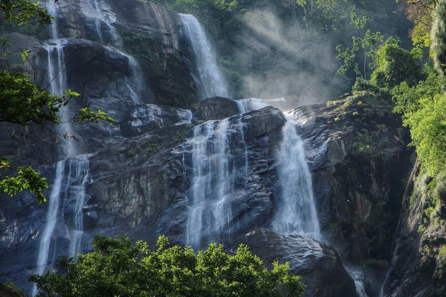
The Udzungwa Mountains National Park covers an area of 1,900 km², making it the 6th largest park in the country, and given the diversity of the country's national parks, it's not very well visited. Created in 1992 - though already partly a Forest Reserve since the 1950s - it boasts a wide range of altitudes: from 300 to 2,576 m! It stretches from the Mwanihana forest, west of Morogoro, to the Kilombero West forest, east of Iringa, and is bordered to the north by the Grande Ruaha River, along which runs the road from Dar to Mbeya (Tanzanian Zambia Highway). Its forests play an important role in the country's economy: construction, utensils, oils and honey, medicinal products... This region has been preserved from human occupation due to its steep mountains, culminating at Luhombero. Some of the waterfalls are impressive, notably the 170 m-high Sanje Falls.
What to visit Udzungwa Mountains National Park?


Suggested addresses Udzungwa Mountains National Park
Weather at the moment
Advertising
Organize your trip with our partners Udzungwa Mountains National Park
Transportation
Book your plane tickets
Car Rental
Boat rental
Accommodation & stays
Find a hotel
Holiday rental
Find your campsite
Tailor-made trip
Immersion travel
Services / On site
Activities & visits
Find a doctor
Find unique Stay Offers with our Partners


Other destinations nearby Udzungwa Mountains National Park
100 km away