MOUNT AIGOUAL
Go there and contact

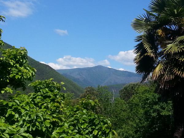
A mountain in the southern Massif Central, the highest point in the Gard and the second highest in Lozère, ideal for hiking.
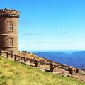
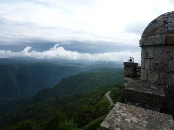
Mount Aigoual, located in the southern Massif Central on the border of the Gard and Lozère departments, is the highest point in the Gard department and the second-highest peak in Lozère and the Cévennes, with an altitude of 1,567 meters. In all seasons, many visitors flock to its summit to admire the remarkable panoramic views. It's worth noting that the summit is generally snow-covered from mid-November to April, with the possible persistence of névés on the north face until June. This is the place to ski in the Gard! Mont Aigoual is distinguished by its exceptional panorama, its special climate, and its renowned meteorological observatory, considered to be the highest point on Mont Aigoual. In the 18th century, the mountain's landscape was once covered with forests, then forests and good pastures. However, in the 19th century, the brutal degradation of the forest and soils, caused by over-exploitation, led to catastrophic floods in 1844, 1856, 1861 and 1868 in particular. It was at this time that Mont Aigoual was the site of the first major anti-erosion reforestation operation in France, involving the creation of a protective forest on soils eroded by deforestation and overgrazing, with the support of the first scientific foundations of phytosociology and pedology. In addition to its ecological importance, Mont Aigoual has historical significance as a place associated with the Camisards and maquisards, and has inspired a number of writers.
Did you know? This review was written by our professional authors.
Further information
Opening time and information on MOUNT AIGOUAL
Free access all year round. Snow equipment for vehicles recommended in winter.
Book the Best Activities with Get Your Guide
Members' reviews on MOUNT AIGOUAL
The ratings and reviews below reflect the subjective opinions of members and not the opinion of The Little Witty.
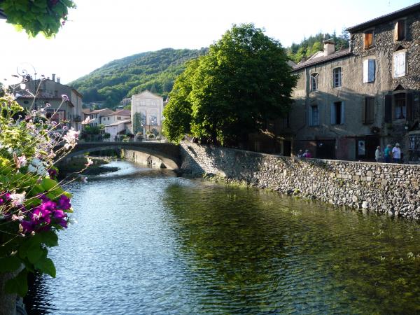
Since Valleraugue, you will reach the top of Aigoual by the path of the 4000 steps, at the top (you arrive at the observatory) is something to eat and drink! Fun, the météosite, on site. The arboretum of Hort of God. and not very far away during summer, go and meet the sheep on the slopes Aigoual (Maison de l'Aigoual, Col de Serreyrède).
When Mont Aigoual no secret for you, go on Valleraugue and before the village, stop at the lake of Mouretou! To swim in invigorating water of the hérault on a sufficiently wide stretch of water to allow you to swim, what a delight!
Find unique holiday offers with our partners


la station meteo vaut le deplacement
la montee en moto est super agreable egalement