The Oise: the territory's blue thread
It meanders from the northeast to the southwest of the urban area. After passing through Saint-Ouen-l'Aumône and Pontoise (it marks the boundary of the two municipalities), it forms a loop, successively irrigating Eragny, Cergy, Vauréal, Jouy-le-Moutier and Neuville and forming a natural amphitheatre, before continuing for a few hectometres and joining the Seine, of which it is one of the main tributaries, at Conflans-Sainte-Honorine. The Oise is wide enough here to allow for navigation - hence the rich history of inland waterway transport in the area. The river originates in Belgium, in the Hainaut region, and after a journey of more than 300 kilometers, it reaches the city of Cergy-Pontoise. In France, it flows through the Nord, Aisne and Oise regions, before reaching the Val-d'Oise and the Yvelines. Its main tributaries (the Aisne, the Serre and the Ailette in particular) and the high level of economic activity in the areas it crosses have encouraged the emergence and construction of numerous canals leading to the Oise, giving it a major role. The flow of the Oise is regular: of course, it is more important in winter, but the variations are largely inferior to those that can be observed with rivers having for source mountainous zones. Here, there are no Cevenol episodes, no sudden melting of the snow that makes the rivers swell. Floods can certainly occur, but the damage is not caused by the fury of the waves, and is the result of the flatness of the surrounding terrain, and the ease with which the water can spread beyond its bed. In the agglomeration of Cergy-Pontoise, there is little risk: the efficient facilities (such as the Pontoise dam, allowing for effective management of the river), and the heights that surround the loop of the Oise, allow a priori to prevent any large-scale natural disaster.
The Hautil massif: to gain height
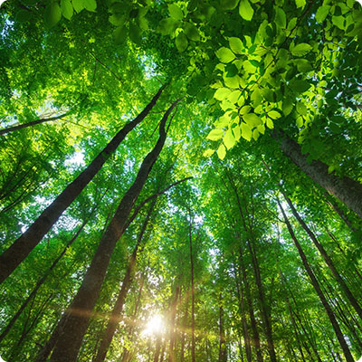
This wooded height logically took the name of massif. It is in fact what is called a "mound" which has not undergone erosion, unlike its immediate environment, allowing it to retain its altitude, and compared to its immediate environment, the impression of height is not due to its own elevation, but rather to the settling of the surrounding areas! It is the marls, which constitute partly the grounds, which support this phenomenon, which one finds elsewhere in Île-de-France, in Montmartre for example. If the ascent to the place can be sportive - the difference in level is of several tens of meters, until reaching 191 m - the summit is in fact a plateau of approximately six kilometers length on a few hundred meters width. The whole area being covered by a beautiful state forest - and thus preserved - you will be able, from here, to have splendid points of view, in particular on Paris, in the distance: the towers of La Défense, the Sacré-Coeur and the Eiffel Tower are at about thirty kilometers. The southern exposure of its slopes has seen, for centuries, the cultivation of the vine: the "vin de France", a small white wine of which it is affirmed that the kings of France were fond, had for origin the slopes of the massif. At the same time, the massif, whose subsoil abounds in gypsum, has been exploited for this purpose since the 18th century. If the quarries are now closed, the subsoil still has countless cavities, making some spaces unstable: this is why the places are forbidden in several places. Some collapses have allowed the creation of small bodies of water: not lakes, but rather small ponds, which add to the quietness of the place and the preservation of biodiversity. Not very practical for agriculture, and in particular breeding, in spite of attempts under Louis XIV, the parts of the massif not being devoted to the vine, nor to the exploitation of the ground, remained covered with forest. The latter has been state-owned since 1970. Today, the Office National des Forêts manages the forestry exploitation, but the Hautil massif is mainly visited by walkers and cyclists.
The Vexin: a fertile plateau
With its agricultural expanses as far as the eye can see, the Vexin would have a false air of Beauce. Here nevertheless, the altitude is higher of a hundred meters on average, from where the appellation of plateau of Vexin. Located at an average altitude of 120 meters, this limestone plateau covered with silt - hence its agricultural virtues - extends from Cergy-Pontoise to Rouen. Pontoise is moreover regarded as the historical capital of the whole. The French Vexin regional nature park, created in 1995, extends over the geographical area up to the gates of the Cergy-Pontoise agglomeration. In addition to the vast agricultural areas, the Vexin has many wooded areas and numerous wetlands, duly listed. Here, the subsoil is composed of successive layers of limestone, sand and clay, allowing the extraction of volumes of stones that have allowed the construction of buildings over the centuries. You who will survey these spaces, you will have here all the leisure to practise, for example, the bicycle: the small axes are numerous, the unevenness rare.
A mild climate
If we are here at a good hundred kilometers from the sea, the climate is not less influenced by the ocean. Thus, if the temperature differences between day and night, and between summer and winter are higher than on the Normandy or Picardy coasts, they remain measured. In the summer, the average temperature is around 25°C in the middle of the day, and the normal winter temperature is around 7°C. Frost is not uncommon, and snow can appear for a few days. If the urban density is high, it has nothing to do with the Parisian hypercenter. Advantage: the heat felt in the streets of the capital during certain heat waves is largely reduced in the agglomeration: here, it is not suffocating, and the Oise River, in these extreme conditions, provides the necessary coolness. Finally, the rainfall, which is more abundant in winter, makes the Oise swell and allows nature to find an environment conducive to its development. All in all, it's good to live here!