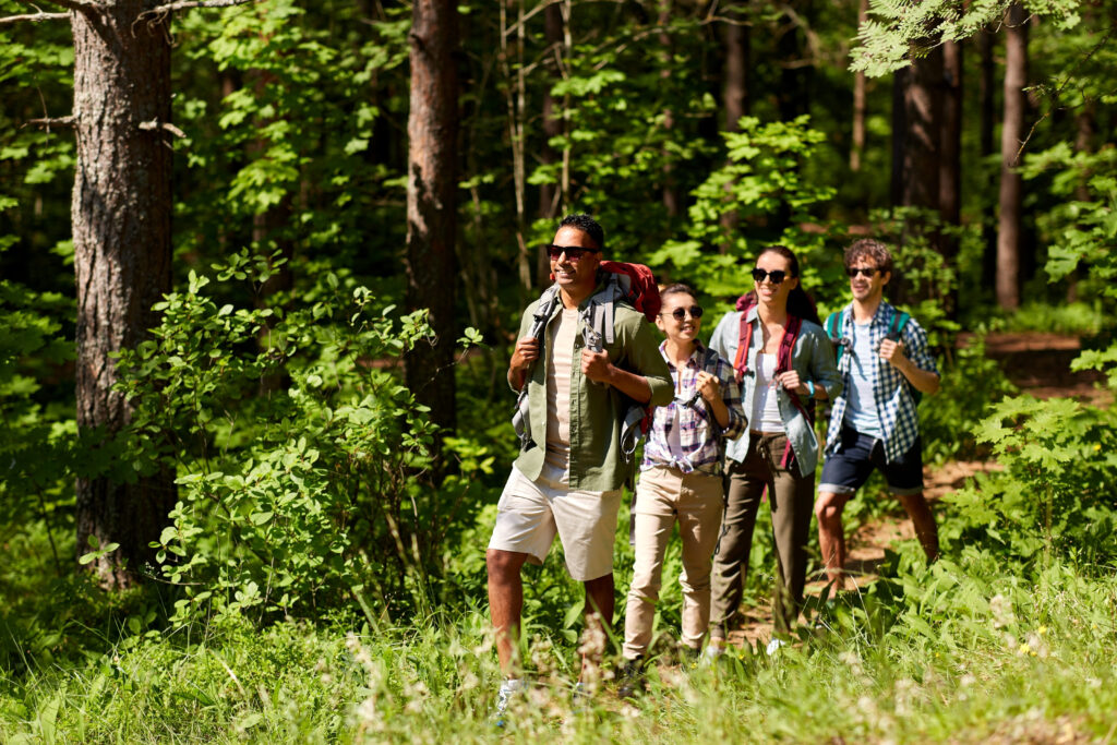
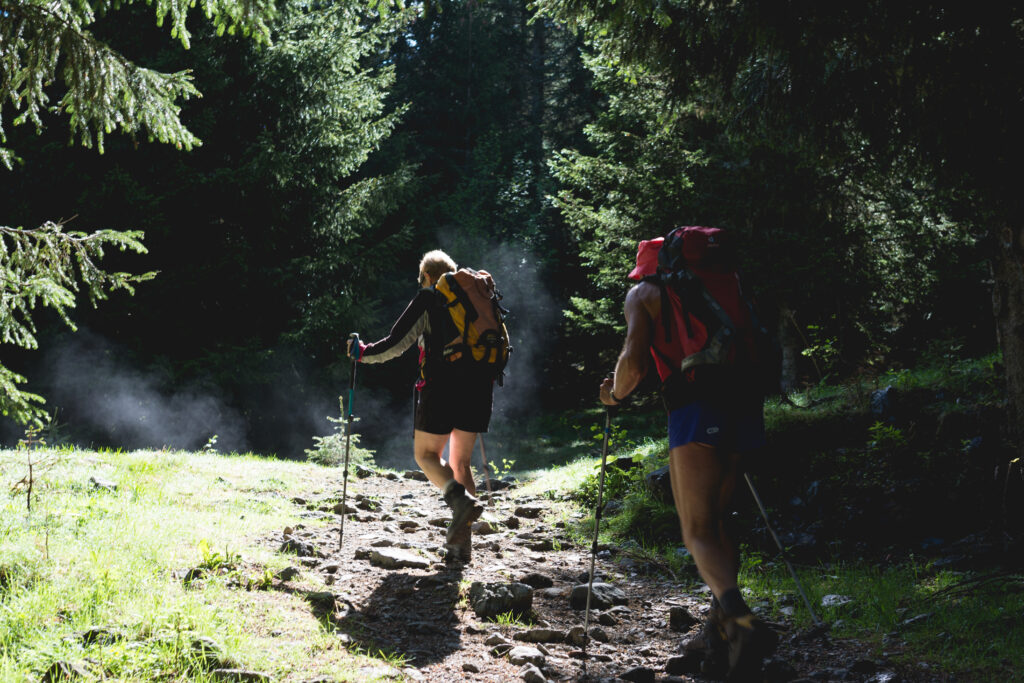
The Franche-Comté region offers a wealth of superb hiking opportunities. Between the lakes and waterfalls of the Jura, the plains of the Haut-Doubs, and the pleasant walks of the Haute-Saône and Territoire de Belfort, the region is one of the best for hiking.
1. Les Mille Étangs
- Distance: 40 km
- Difference in altitude: 1,000 m
- Duration: 1 to 2 days
- Itinerary
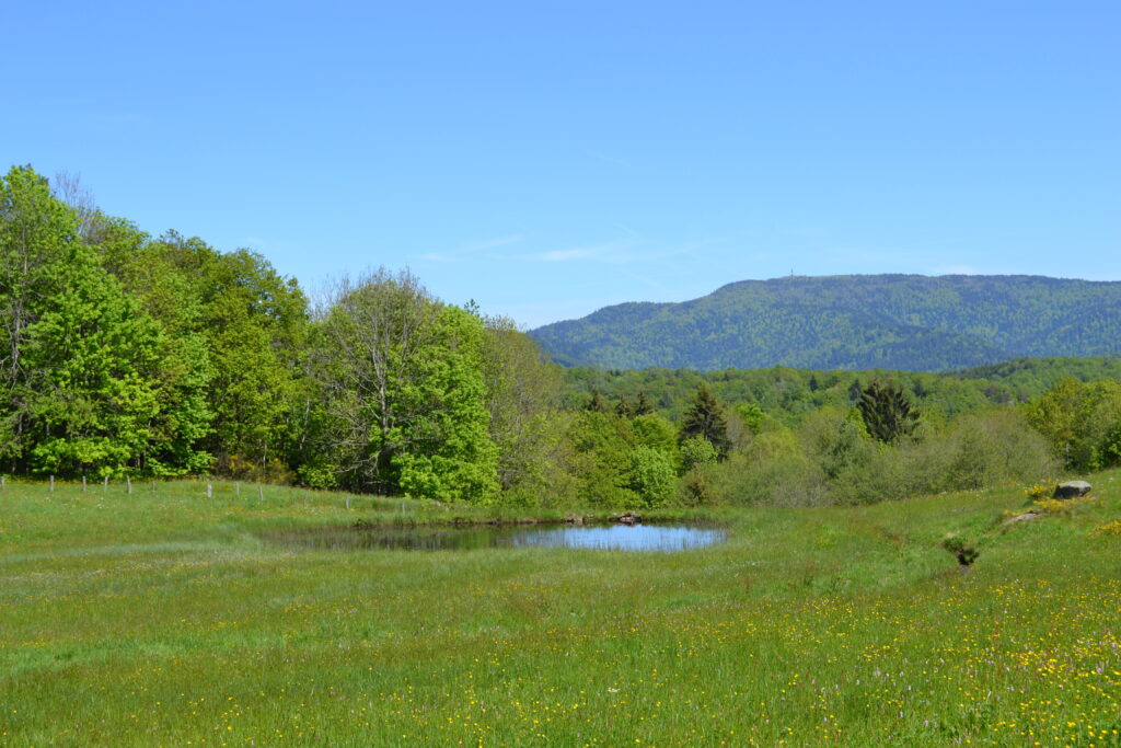
The Mille Étangs plateau in Haute-Saône is one of the most beautiful hikes in Franche-Comté. To be precise, there are not 1,000, but 850 ponds here, formed thousands of years ago by the melting of an ancient glacier. This phenomenon has given rise to an extremely fragile ecosystem, and hikers are advised to be careful about their environmental impact. This is a difficult hike, as it is very long and involves a considerable difference in altitude. Only experienced hikers can complete this loop in one day, in around 10 hours. Other hikers will need to make an overnight stop, or choose an easier trail, as the Mille Étangs have many of these.
2. Lac du Malsaucy
- Distance: 11.5 km
- Elevation gain: 255 m
- Duration : 4 h
- Itinerary
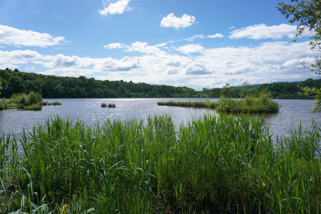
Lac du Malsaucy offers hikers and cyclists a pleasant, easy ride. The route is also very popular with runners, or even kayakers, and you can rent or buy your equipment on site at the leisure center. In fact, it's not just one lake, but a dozen or so combined ponds.
3. La Grande Traversée du Jura
- Distance: 400 km
- Altitude difference: 15,000 m
- Duration: 15 to 25 days
- Itinerary
The Grande Traversée du Jura is more officially known as the GR®509. In fact, it's a Grande Randonnée itinerary, meaning it can be hiked in Franche-Comté or elsewhere over several days. You'll cross the Jura, one of France's greenest regions, and discover its waterfalls, lakes, forests and rich gastronomy. It will take several days to complete this challenging trail, so you'll be able to bivouac at authorized sites.
As well as being possible on foot, the Grande Traversée, or at least certain sections of it, can also be done by gravel bike, mountain bike, cross-country/nordic ski, snowshoe and even on horseback. It's one of the most versatile GR trails in France!
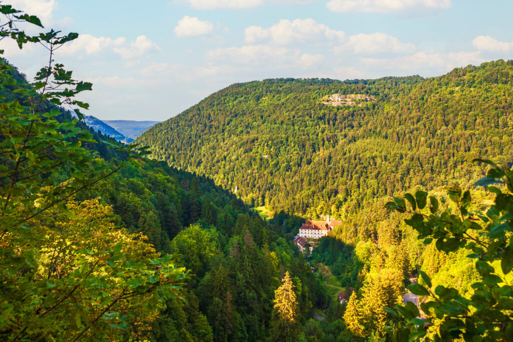
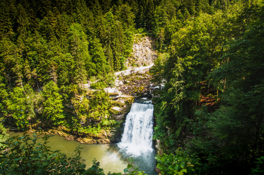
4. Cirque de Consolation
- Distance: 7 km
- Elevation gain : 450 m
- Duration: 3 hrs 30 mins
- Itinerary
This hike in Franche-Comté, more precisely in the Doubs region, is a tough one, as it's quite steep. But it's well worth the effort, as you'll be climbing above the cirque de Consolation: a rounded cliff in the Jura massif, with a waterfall at its heart. In addition to these natural charms, the visit is also a cultural one, as the site is home to an ancient monastery. In other words, the Cirque de Consolation is a must-see in Franche-Comté!
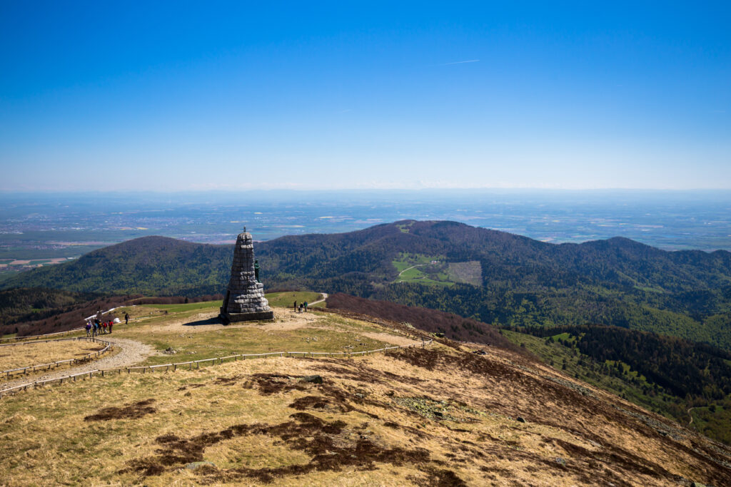
5. The Ballon d'Alsace
- Distance: 10 km
- Difference in altitude: 405 m
- Duration : 4 h 30
- Itinerary
The Ballon d'Alsace is an off-the-beaten-track destination, and the inspiration for this superb hike in Franche-Comté. This 1,247 m high peak in the Southern Vosges is a superb natural area, home to many fascinating species, including chamois. Because of its steepness, this route is considered to be of medium difficulty, with some of the steeper sections being even more difficult. The Ballon d'Alsace also has the distinction of being located at the crossroads of three regions: Franche-Comté, Alsace and Lorraine. As such, it is also the meeting point of three départements: Territoire de Belfort, Haut-Rhin and Vosges.
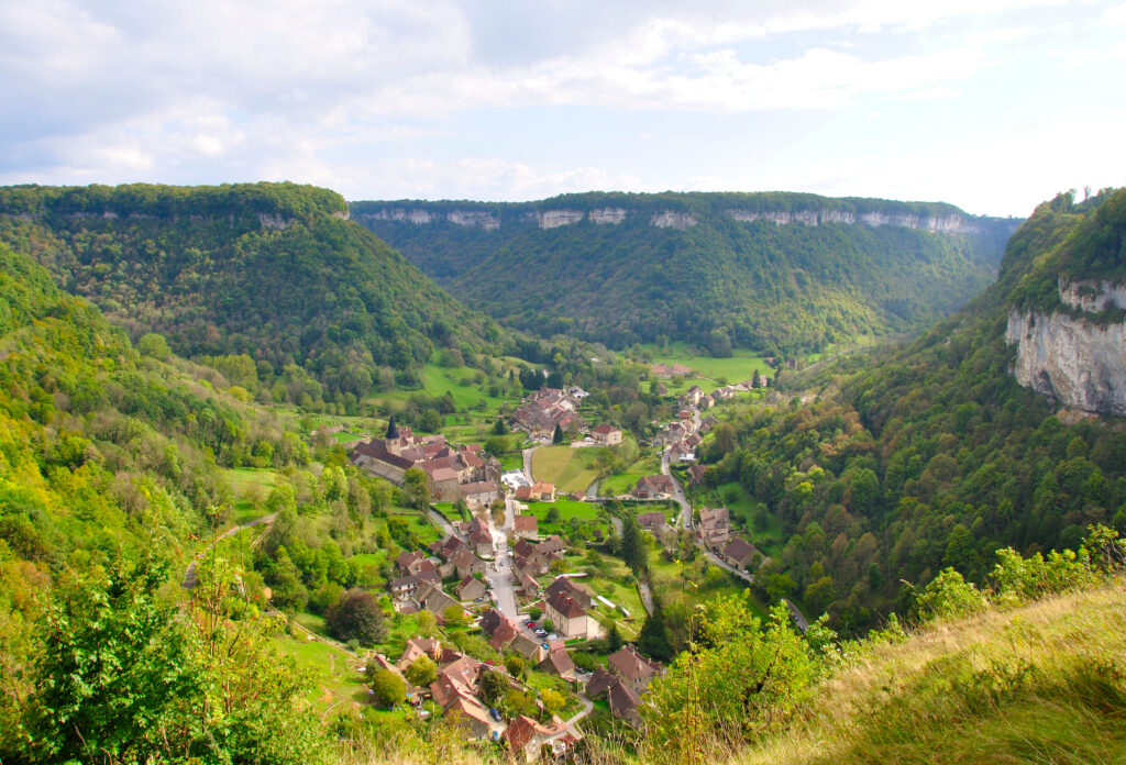
6. The reculée of Baume-les-Messieurs
- Distance: 8 km
- Difference in altitude: 356 m
- Walkingtime : 3 h
- Itinerary
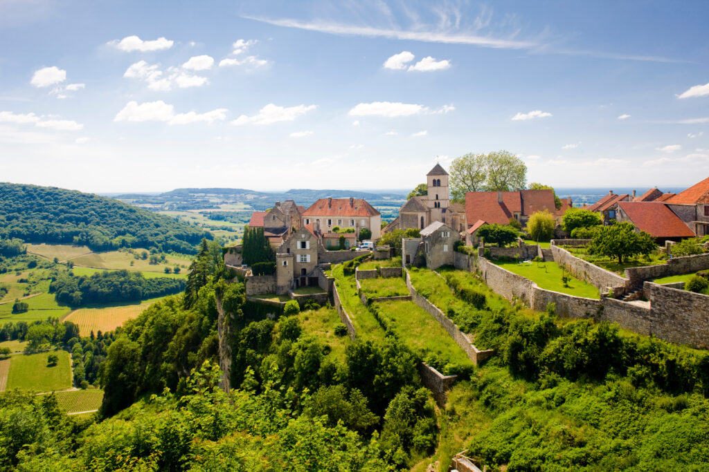
The reculées are a typical Jura landscape. They are steep-sided valleys that end in a dead end, like a mountain cirque. And of the many reculées in the Jura, Baume-les-Messieurs is considered the most beautiful. The village of the same name, one of France's most beautiful villages, lies in the hollow of the reculée, making it a destination away from mass tourism in the Jura. There's even a waterfall and cave at the bottom of the valley! This medium-level itinerary explores this spectacular landscape, first passing through the village before climbing up to a belvedere.
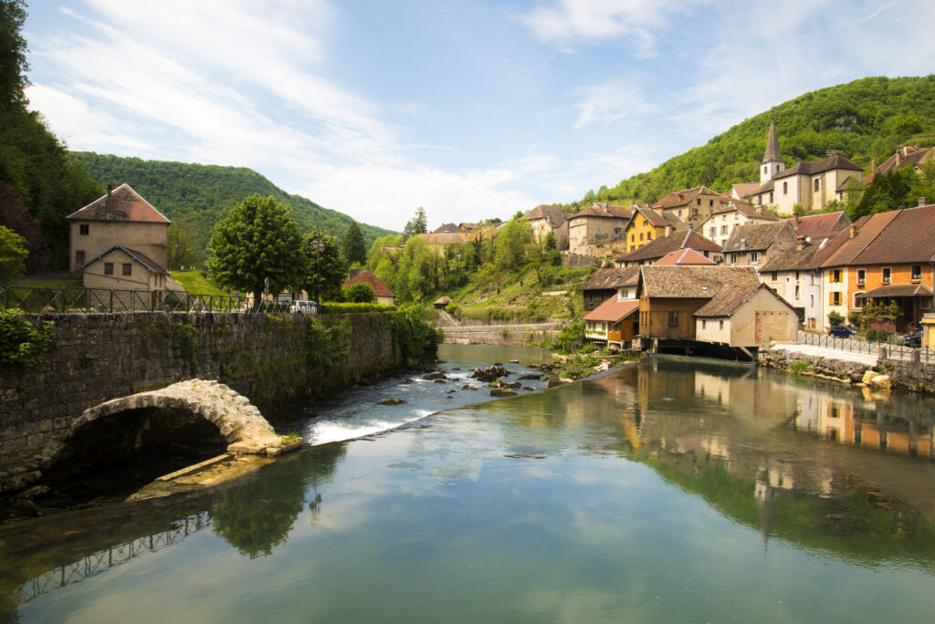
7. The Loue valley
- Distance: 10 km
- Difference in altitude: 350 m
- Duration : 3 h
- Itinerary
The Loue valley, in the Loue region, offers some of the finest hiking in Franche-Comté. The river basin is lined with natural landscapes and historic villages, including Ornans, famous for one of its illustrious inhabitants: the painter Courbet. The starting point is the village of Ornans, before setting off to conquer the heights of the valley, offering superb panoramic views. Ornans has poor public transport links, apart from the MobiGo LR204 bus from Besançon, but hitchhiking is common in the region.
8. The Hérisson waterfalls
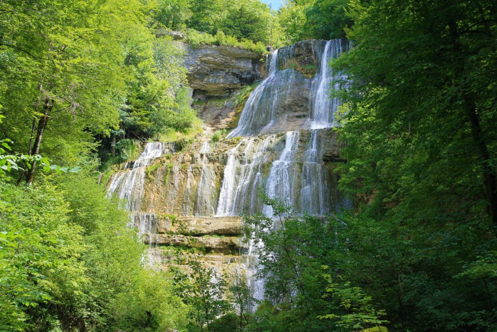
- Distance: 7 km
- Height difference: 275 m
- Duration : 2 h 20
- Itinerary
This is a medium-level hike, as it includes a little relief, and sets out to conquer one of the most beautiful landscapes in the Jura: the Hérisson waterfalls. The torrent makes 31 consecutive jumps, near the village of Doucier. This postcard-perfect setting is currently awaiting classification as a Grand Site de France, which rewards spectacular natural sites that reconcile tourism and environmental conservation. So when you're out hiking, be sure to take steps to protect the environment.
9. La Planche des Belles Filles
- Distance: 3 km
- Difference in altitude: 157 m
- Duration : 1 h
- Itinerary
La Planche des Belles Filles is a mythical peak offering some great hiking opportunities in Franche-Comté. Indeed, this peak in the Vosges massif, culminating at 1,148 m, is a Tour de France staple. It has been climbed by cyclists more than 6 times, making it one of the race's most covered stages. For cyclists, the summit is particularly challenging, with gradients ranging from 8 to 24%! Rest assured, for this tour we've selected an average, fairly steep, but short route.
10. Les Échelles de la Mort
- Distance: 9 km
- Difference in altitude: 500 m
- Duration : 3 h
- Itinerary
This magnificent hike near Charquemont explores the Échelles de la Mort. In bygone days, smugglers would use this steep valley from Switzerland to escape the gaze of customs officials. They used tree-trunk ladders, which have since been modernized to the delight of hikers. Because of the altitude difference, this is a difficult hike. Along the way, you can also admire the Doubs gorges , the Cendrée belvedere and the Grotte aux Moines.
11. Lake Chalain
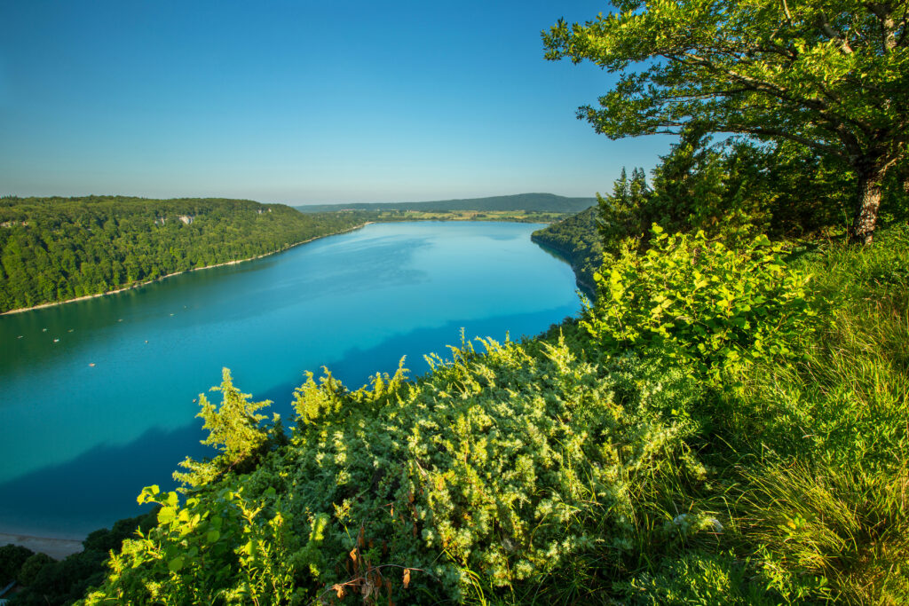
- Distance: 12.2 km
- Difference in altitude: 278 m
- Time : 4 hrs 30 mins
- Itinerary
Lac de Chalain is one of the most beautiful lakes in the Jura, and one of the best destinations for eco-travel in France, as there are so many nature activities around it. This easy loop takes you around the lake without too much change in altitude. The department's largest natural lake will still require a little time to tame!
To take your discovery of France on foot one step further, take a look at our articles on the best hikes in the Pyrenees, Auvergne and Alps.


