Travel Guide Lac Abaya
Find an accommodation
Advertising
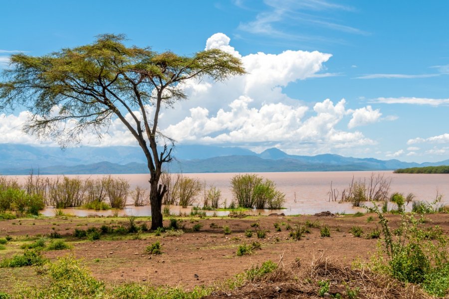
Located in the Rift Valley, covering an area of 1,160 km2over some 60 km from north to south and 20 km wide, Lake Abaya is Ethiopia's longest and second-largest lake. It is surrounded by floodplains and swamps. It is fed by five main rivers, including the Bilate, which flows from Mount Gurage. Lake Abaya, shallow (13 m), has a coppery-brown hue, characteristic of its ferruginous waters. In its southern part, it is separated from Lake Chamo by Nechisar National Park. There are several islands, including Aruro, the main one, as well as Gidicho, Welege, Galmaka and Alkali.
Suggested addresses Lac Abaya
Weather at the moment
Advertising
Organize your trip with our partners Lac Abaya
Transportation
Book your plane tickets
Car Rental
Boat rental
Accommodation & stays
Find a hotel
Holiday rental
Find your campsite
Tailor-made trip
Immersion travel
Services / On site
Activities & visits
Find a doctor
Lac Abaya travel inspiration


Find unique Stay Offers with our Partners


Other destinations nearby Lac Abaya
100 km away