Travel Guide Kafolo
Find an accommodation
Advertising
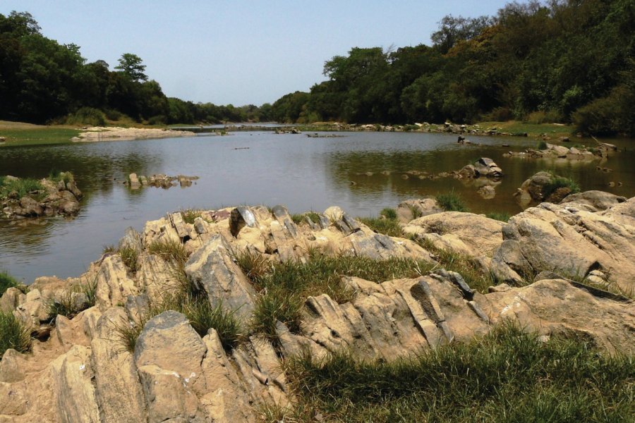
The village of Kafolo, also called "Petit Ferké", is located on the Ferkessédougou-Bouna axis, at the precise point where the Comoé River, which rises in the Bandiagara cliffs in Burkina Faso, enters Côte d'Ivoire before reaching the ocean at Moossou (Grand-Bassam). Most of its inhabitants, about a thousand, are Dioulas; they cohabit with Ghanaian fishermen, Lobis, as well as Burkinabe, Malians and Mauritanians. Islam is the dominant religion Red zone. A jihadist attack that resulted in the death of 14 Burkinabe and Ivorian soldiers took place on June 10, 2020. Ten days later, the Ivorian Minister of Defense announced the capture of the leader of the jihadist attack, which has not been claimed. Following this attack, the first since 2016, a military operational zone was created in the north of the country, on the borders of Côte d'Ivoire, Burkina and Mali. Kafolo and the Comoé National Park are now classified as a red zone by the French Ministry of Foreign Affairs, and it is therefore formally inadvisable to travel there.
Suggested addresses Kafolo
Weather at the moment
Advertising
Organize your trip with our partners Kafolo
Transportation
Book your plane tickets
Car Rental
Boat rental
Accommodation & stays
Find a hotel
Holiday rental
Find your campsite
Tailor-made trip
Immersion travel
Services / On site
Activities & visits
Find a doctor