A contrasted territory around the Via Emilia
Emilia-Romagna is a very flat region in northern Italy. It is divided into nine provinces, each bearing the name of its own capital. From west to east, Piacenza, Parma, Reggio Emilia, Modena and Bologna. From north to south, along the Adriatic coast: Ferrara, Ravenna, Forlì-Cesena and Rimini. It is spread out on either side of the Via Emilia. This straight Roman road was laid out in the 2nd century B.C. by the Roman consul Marcus Aemilius Lepidus, and links Piacenza in the northwest to Rimini in the southeast. It is followed by today's road and rail network. The Via Emilia has given its name to the region.
The Po Valley
Sandwiched between the Alpine arc to the north and the foothills of the Apennines to the south, the Po basin extends over almost 50,000 km² in several Italian regions: Piedmont, Lombardy, Emilia-Romagna, Veneto and Friuli-Venezia Giulia. The main feature is the Po, the longest river in Italy: along its 652 km course, it receives the waters of several tributaries with which it drains a vast network of lowlands to which it has given its name. The pianura padana (Padana plain) is the country's main agricultural and economic region. Its vast, flat, fertile expanses have favored the development of agriculture, transportation and industry, as well as significant urbanization. Northern Italy owes much of its prosperity to the Po.
The river eventually flows into the Adriatic in a wide delta, which remained marshy for a long time before being partially reclaimed and cultivated. This expanse of plains is the domain of intensive farming. The landscape is one of cultivated fields bordered by poplar and willow hedges, and irrigation or drainage canals.
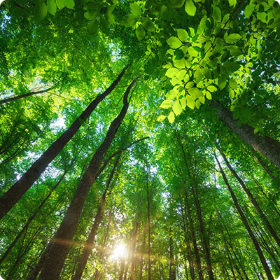
The Apennines
The mountain range stretches for almost 1,000 km across 15 regions of Italy, from north to south. In Emilia-Romagna, the Apennines separate the region from its Ligurian and Tuscan neighbors. The Ligurian Apennines are interrupted by the Cisa pass, crossed by the freeway linking Parma to La Spezia. This is followed by the Tuscan-Emilian Apennines, characterized by a main ridge line linking parallel mountain groups. Several peaks reach 2,000 meters, with the highest point, at 2,165 m, being Mount Cimone in the province of Modena. In winter, you can even go skiing at Corno alle Scale (1,945 m) in the province of Bologna. In summer, it's the ideal place to hike along the Via degli Dei between Bologna and Florence. Finally, the Tuscan-Romagna Apennines start at the Col de la Futa, linking Bologna to Florence. It stretches across Romagna, Tuscany and San Marino, and still boasts large wild forests, especially in the Parco nazionale delle Foreste Casentinesi.
The Adriatic coast
The coastline stretches some 130 km from Comacchio to Cattolica. Along the coast, you'll find a succession of protected natural areas, formed by the delta of several rivers, pine forests, salt marshes and vast stretches of sand. The Romagna Riviera, covering the provinces of Ravenna, Forlì-Cesena and Rimini, attracts large numbers of holidaymakers every year thanks to its wide sandy beaches, ideal for lounging and seaside activities. The coast of the province of Ferrara is less popular with seaside tourists, as it is largely occupied by the Po delta, a protected reserve, and is of greater interest to lovers of nature and green tourism.