A contrasted territory around the Via Emilia
Before looking at the physical geography of Emilia-Romagna, let's draw up a general framework: Emilia-Romagna is a region in northern Italy whose capital is Bologna. It covers a total surface area of 22,458 km2 and is administratively divided into nine provinces, each with its own chief town. From west to east, one encounters successively : Piacenza, Parma, Reggio Emilia, Modena and Bologna; then, from north to south along the Adriatic coast: Ferrara, Ravenna, Forlì-Cesena and Rimini. Emilia-Romagna has a coastal face to the east, along the Adriatic Sea, and shares a common border with six other Italian regions: Veneto, Lombardy, Piedmont, Liguria, Tuscany and Marche.
Three physical environments (river, mountain and sea), with the Po to the north, the Apennines to the south-west and the Adriatic Sea to the east, characterise the landscape of the region, and their geographical distribution is marked by the Via Emilia, the Roman road built in the 2nd century BC by the Roman consul Marcus Aemilius Lepidus. This rectilinear axis connects Piacenza in the north-west to Rimini in the south-east and is still today the backbone of Emilia-Romagna: its route is followed by today's road and rail network. The fact that the Via Emilia has bequeathed its name to the region is enough to underline its importance, since it is along this centuries-old communication route that the region has developed and structured itself. With the exception of Ferrara and Ravenna, all the provincial capitals are situated along its route.
The Via Emilia crosses the region diagonally and determines two distinct geographical areas: to the north, the Po plain, or Padana plain, occupies almost half of the region's total surface area, and to the south, the foothills of the Apennines gradually rise, which then stand like a natural rampart facing Tuscany. These areas of hills and mountains share the other half of the region's total surface area equally.The Po Valley
Wedged between the Alpine arc to the north and the first foothills of the Apennines to the south, the Po basin covers nearly 50,000 km² over several Italian regions: Piedmont, Lombardy, Emilia-Romagna, Veneto and Friuli Venezia Giulia. The Po is the longest river in Italy: along its 652 km course, it receives water from several tributaries with which it drains a vast network of lowlands to which it has given its name. The pianura padana
(Padana plain) is the main agricultural and economic region of the country. Its vast flat and fertile expanses have favoured the development of agriculture, transport routes and industries, as well as significant urbanisation. The Po can be considered to be the source of most of Northern Italy's prosperity. The river eventually flows into the Adriatic Sea in a wide delta that remained marshy for a long time before being partially reclaimed and cultivated. This expanse of plains is the domain of intensive cultivation. There is a landscape of cultivated fields bordered by poplar and willow hedges and irrigation or drainage channels.The Apennines
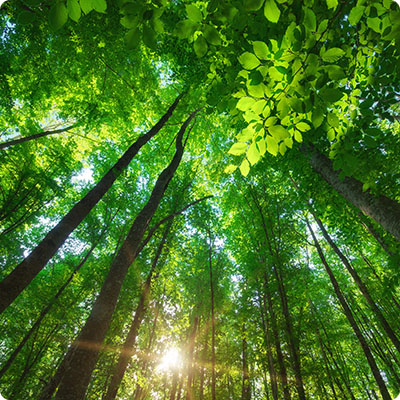
The mountain range runs for a thousand kilometres across Italy from north to south through fifteen regions; it is in a way the backbone of the peninsula. In Emilia-Romagna, the Apennines follow a diagonal north-west and south-east trajectory, separating the region from its Ligurian and Tuscan neighbours. The Ligurian Apennines first meet the Ligurian Apennines, which are interrupted by the Cisa Pass, crossed by the motorway linking Parma to La Spezia. This is followed by the Tuscan-Emilian Apennines, characterised by a main ridge line from which parallel mountain groups stand out, following a fishbone pattern, which rapidly decline towards the surrounding hills. Several peaks reach 2,000 metres and the highest point, at 2,165 metres, is Mount Cimone in the province of Modena. In winter, the presence of snow allows skiing, as at Corno alle Scale (1,945 m) in the province of Bologna. In summer, it is the ideal place for hiking. In recent years, for example, a hiking trail called Via degli Dei, which links Bologna to Florence in Tuscany, has become increasingly popular. Finally, the Tuscan-Romagna Apennine starts from the Futa Pass, which is crossed from Bologna to Florence, and stretches over Romagna, Tuscany and San Marino. It still preserves large wild forests, especially in the Parco nazionale delle Foreste Casentinesi, a protected park shared by Emilia-Romagna and Tuscany.
The Adriatic coast
The coastline stretches about 130 km from Comacchio to Cattolica. Along the coast there are a succession of protected natural areas, formed by the delta of several rivers, pine forests, salt marshes and vast expanses of sand. The Romagna Riviera, which covers the provinces of Ravenna, Forlì-Cesena and Rimini, attracts many holidaymakers every year thanks to its wide sandy beaches suitable for relaxing and all seaside activities. The coast of the province of Ferrara is less popular for seaside tourism as it is largely occupied by the Po Delta, which is a protected reserve; it is more interesting for nature and green tourism enthusiasts.
The hydrographic network
Emilia-Romagna is a very fertile region. Its land is fed by the many rivers that originate in the Apennines and flow down the valleys following a south-west and north-east trajectory. They end up in the plain and swell the river beds, starting with the Po in the north of the region. Another major river is the Reno, the longest in Emilia-Romagna after the Po, which runs 211 km from its source in the Apennines to its estuary on the Adriatic coast. It receives waters from several tributaries and its basin extends over a large part of the region (about 6,000 km2).
Several artificial canals have also been constructed for irrigation, marshland reclamation, civil and industrial uses. The Canale Emiliano Romagnolo, one of the most important hydraulic works in Italy, irrigates the entire Romagna area over its 135 km length. Fed by the waters of the Po and Reno rivers, it ensures a constant supply of water to the whole of Romagna, even during summer droughts, which is of interest to all sectors: agricultural, industrial and civil. The meadows where the dairy cows graze are irrigated, as are the cereal fields and the low hills planted with vineyards. The Acquedotto della Romagna, meanwhile, guarantees a supply of drinking water to about fifty municipalities in Romagna and the Republic of San Marino.
Finally, it is in Emilia-Romagna that the Tiber has its source: it originates on Mount Fumaiolo, which rises at an altitude of 1,407 m in the Tuscan-Romagna Apennines; a Roman column marks the place, while a marble slab reminds us that "Here the sacred river to the destinies of Rome is born"! But its presence in the area is only a few kilometres away.