Appearance of the Lesser Antilles
It was during the Cretaceous period (between 135 and 65 million years ago) that the Atlantic appeared, starting with its southern part. Volcanic activity began in the Lesser Antilles arc during the Upper Cretaceous, but the islands appeared in the Eocene era. The volcanic arc of the Lesser Antilles is the result of the westward movement of the Atlantic plate, which pushes the American continental plate underneath. This is how around twenty islands came into being, including Saint-Barth, Saint-Martin, Saba and Anguilla. However, the Lesser Antilles cover only 10% of the total surface area of the West Indies!
One of the oldest islands in the Caribbean
The island of Saint-Barthélemy lies at 18° N and 63° W in the extreme northeast of the Caribbean Sea, 6,000 km from Paris, 2,500 km from New York, 180 km from Puerto Rico and 24 km southeast of Saint-Martin (13 nautical miles). Just over 21 km² (24 km² with its islets). Ile Chevreau, Coco, Ile Fourchue (a major yachting anchorage), Ile Frégate, La Tortue, Ile le Boulanger, Les Grenadins, Pain de Sucre, Ile Pelé, Ile Petit Jean, Toc Vers, Les Gros Islets, Les Petits Saints, Roche Plate (Table à Diable), Mancel (La Poule et les Poussins) make up its close guard of islets.. Saint-Barthélemy was formed between the Cretaceous (secondary) and Eocene (lower Tertiary) periods, making it one of the oldest volcanic islands in the Caribbean. It was formed by several phases of underwater volcanism. The 2 tectonic plates (American and Caribbean) are very active, and it's not unusual to feel small tremors.
The hills or small mountains known as "mornes" are volcanic in form. Le Morne de Vitet (286 m) is the island's highest point. And the areas known as "fond", such as the plaine de Grand-Fond or the plaine de Saint-Jean, are the legacy of depressions forming lagoons that millions of years of sedimentation have finally filled in.
Two distinct geographical areas
During your stay, you'll quickly realize that the wind blows more on the east coast of Saint-Barth than on the west coast, which is much more sheltered thanks to the mountains. Steep hills divide it into valleys, most of which open onto the sea. Each valley has its own particular character, with its own unique topography, habitat and architecture. This is why the island appears larger than it really is. Twenty-two beaches surround the island, each with its own character, which is remarkable for such a small area. Most are protected from the ocean swell by a coral reef. All are public beaches.
The six geographical faces of the island
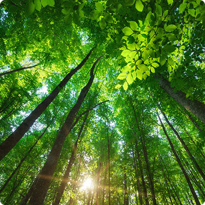
The island's volcanic heritage is reflected in its arid, rocky soil. The island is largely covered by dry forest. This typology favors the emergence of tough plant species whose roots play a role in combating erosion. This rugged, hostile soil has never favored the development of agriculture. The flora that thrives here has to adapt to low water levels. These include the rot-resistant guaiac tree, the cherry tree, the red gum tree with its pungent bark, and the latan tree, whose young leaves were used to make baskets.
Another feature of Saint-Barth is its rugged coastline, which plunges straight down to the sandy beaches. It provides excellent shelter for nesting and seabirds. As you stroll along the rocky coastline, you may come across brown pelicans, peacock-tails, English cactus, wild frangipani..
Between land and sea, the marshes and wetlands play an essential role in filtering pollution from the surrounding environment. The ponds are home to a mangrove of mangroves, recognizable by their aerial roots. These imposing roots protect against the swell. The brackish waters attract large wading birds such as egrets, but crabs are not to be outdone! And let's not forget the iguanas (from the Lesser Antilles), who love to strut their stuff along the ponds and nibble on the mancenilla trees.
The beaches, in addition to hosting our bathing towels, are home to root crops that resist salt water, swell and wind, and help maintain natural shorelines in the face of erosion. The sea potato, recognizable by its beautiful pink flower, maintains the coastal soil with its creeping roots. Coastal grapes and sea purslane adapt to this sandy, salty environment. Animals such as horseshoe crabs and sea turtles need beaches to lay their eggs or live.
The natural underwater environment is the island's second richest natural resource. Like the Amazon forest on land, the seagrass beds are a green lung for the underwater ecosystem. The leaves of the various varieties of seagrass retain sediment, while the rhizomes help to fix it. Saint-Barth is home to endemic seagrass species such as manatee grass and turtle grass. This rich vegetation attracts green turtles.
The coral reef is also very important: no fewer than 51 species of coral can be found in Saint-Barth's waters (out of 72 in the Caribbean). As well as providing shelter, nurseries and larders for fish and crustaceans, the coral reef plays a protective role against swell. The reef's ecosystem is particularly rich, and a number of associations, such as Coral Restoration St Barth and Island Nature Saint Barth, are working to re-establish the corals. You can easily reach the Grand Cul-de-Sac bay nature reserve and observe elkhorn coral, brain coral, fire coral, porite coral... Hurricane Irma in 2017 fractured many corals that these three organizations are working to restore.