The Urals
The westernmost region: until the end of the 16th century and the conquest of the East by the Cossack mercenaries, after the Urals, there was nothing... This mountain range (Mount Narodnaya culminates at 1,894 m) with a meridian orientation stretches for nearly 2,000 km, between the Kara Sea (Arctic zone) and the steppes of Kazakhstan. It traditionally marks the border between Europe and Asia. It covers an area of 1.8 million km² and is home to approximately 18 million people. The north, located beyond 64° latitude, is subject to the climate of the tundra (extreme cold). The central and southern parts are the most developed, heavily forested. A subsoil rich in raw materials (oil, iron, bauxite, asbestos, chromium, platinum, gold) has made it, since the 18th century, the seat of a powerful industry, now in decline. The rock salt deposit in the Perm Oblast alone accounts for almost half of the world's resources. There are four towns in the Urals with more than 1 million inhabitants: Perm and Ekaterinburg in the centre, located at kilometre 1434 and 1814 respectively of the Trans-Siberian Railway; Chelyabinsk and Ufa in the south. About 200 km from the latter is the South Urals Nature Reserve (Yuzhno Uralskiy zapovednik), established in 1978, which is home to about 1,300 plant species and 260 species of vertebrates. It includes Mount Iamantau (Republic of Bashkiria, 1,640 m) which has an equivocal reputation: some conspiracy theorists see it as the Russian counterpart of the famous Zone 51. It is believed to house a huge underground military complex from the Brezhnev period.
Western Siberia
The largest plain region on the planet (2.7 million km²). It stretches from the eastern Urals to the Yenisei River (3,800 km; flows north into the Kara Sea). It is, however, the shortest in the region, which is also watered by the Ob (5,410 km), which feeds the gigantic Novosibirsk hydroelectric power plant, and its tributary, the Irtysh (4,248 km). Between them lies one of the largest swampy areas in the world, the Vasyugan Marsh (53,000 km²). Both rivers have their source in the Altai massif, which closes off western Siberia to the south-east for about 2,000 km.
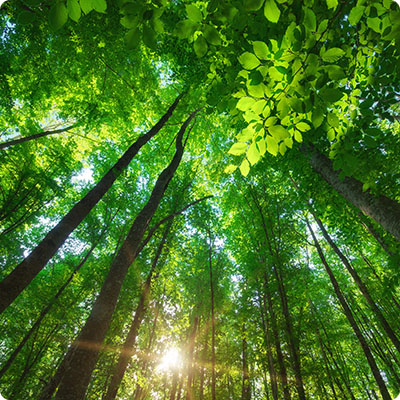
The Altai, nicknamed Switzerland or Russian Tibet, has several 4,000, including its highest point, Mount Katoun (4,506 m). It compiles, in addition to dizzying peaks, high plateaus, plains, medium mountains, dry grass steppes and other dark taiga. Lovers of breathtaking postcards, go on a road trip
on the road to Chuia (or R-256, or M-52, Novosibirsk-Biysk link, with a view of the snowy peaks). Don't forget also to walk in the Kyzil-Tchin region, the Mars of the Altai. A high mercury content gives it this fabulous red colour and, to you, the impression of having left the Earth. The region is home to the Great Altai Biosphere Reserve, created in 2017 and transboundary with Kazakhstan (UNESCO): 1.5 million hectares dedicated to livestock and fodder, activities entrusted to its 24,000 inhabitants. In the 1930s, an inexhaustible nickel deposit (still being mined) led the Stalinist authorities to found the Norillag Gulag, a secret prison city, since renamed Norilsk and still closed. It is one of the legendary polluted cities of the Far North (175,000 inhabitants, 69° latitude). In the 1960s, Western Siberia became a vast hydrocarbon production area (oil in the Middle Ob and natural gas in the north). The region is therefore highly developed. Nearly 15 million people live there, especially in the large (and no less charming) industrial cities of Omsk (km 2,711 of the Trans-Siberian Railway; 1.17 million inhabitants) and Novosibirsk (km 3,336; 1.58 million inhabitants). Don't miss the cheerful Tomsk, with its wooden quarters, the first university town in Siberia (570,000 inhabitants). You can easily explore Western Siberia by train, radiating around the Trans-Siberian line, especially from Novosibirsk, an important railway hub.Eastern Siberia
Slightly less populated (9.1 million inhabitants), the region is... immense. It stretches from the Yenissei (Krasnoyarsk krai, in which you practically house the European Union) to the Lena. The river originates in the very south, in the Baikal Mountains, and flows 4,400 km north into the Laptev Sea, which is very landlocked and therefore very cold (it can be navigated by icebreaker in the summer until September). Other rivers flow here, including the Angara (1,779 km), one of the countless "sons" of Lake Baikal. This is one of the particularities of the region: an exceptional hydraulic heritage and gigantic dams that you can visit.
Eastern Siberia is geologically the Central Siberian Plateau, a low-lying relief (500-700 m) surrounded to the south-west by the Saian Mountains (including the Mounkou Sardyk, 3,492 m, located on the Russian-Mongolian border) and to the south-east by the Iablonovy and Cherski ranges, which are less vertiginous (east of Lake Baikal). The richness of the subsoil is colossal: tin, coal (almost 50% of Russia's reserves), copper, mica (a rather rare deposit), lignite, gold. Their exploitation is not new - it is historically associated with forced labour and the famous exile in Siberia. Many dissidents, including the Decembrists, were imprisoned in the present krai of Transbaikalie, around Chita (344,000 inhabitants), where various katorga
had been established as early as the 18th century.Krasnoyarsk (1.07 million inhabitants) is an important stage of the Trans-Siberian Railway (km 4,098): the city, although ultra-modern, with a heavy industrial past (especially nuclear, since it has housed two sensitive, unmapped sites, Kasnoïarsk-26 and 45), has a very pretty town centre. The famous Irkutsk, the second largest city in population (km 5 185, 623 000 inhab.), is nicknamed the "Paris of Siberia", a cultural influence that it owes to the Decembrist revolutionaries. Extremely touristic, it is the most popular access to the wonderful Lake Baikal (seaside resort of Listvianka, about 70 km to the south). The exceptional biodiversity of the oldest and deepest freshwater reserve on the planet has led to the creation of several protected areas, including the Baikal-Lena Reserve (Baikalo-Lenski zapovednik, north shore) and the Zabaikalski Nature Park (south-east shore, home to the fabulous Sacred Nose Peninsula). The Transmongol railway line starts in Ulan-Ude, the capital of Buryatia (km 5,641, 430,000 inhabitants). From Ulan-Oude, you reach the southern shore of Lake Baikal, much wilder (and much less visited).
Finally, very far away, in the north-east, planted on the Lena plain, is Yakutsk, capital of the Republic of Sakha/Iakutia, built on the permafrost (308,000 inhabitants, the largest city of its kind in the world and also the coldest). It is difficult to get there by train (Magistral-Love-Iakutia line, connected to the Trans-Siberian Railway and the BAM), but very easy by plane. In this region, 1/5th of the world's diamond production is extracted: it is here that the famous (and photogenic) open-cast mines of Mir (500 m deep, closed in 2001) and Oudatchnaïa (still active,3rd deepest in the world) are located. Important gold deposits have been exploited more recently.The Far East
The diversity of the environments is such that it makes you dizzy... The region has four sea entrances. To the north and northeast, it opens onto the seas of Eastern Siberia and Chukchi (icy Arctic Ocean), both located in the polar zone. To the east and southeast are the Bering, Okhotsk and Japanese Seas, which are cold but subject to the tropical influence of the Pacific. They are extremely rich in fish, with 800 listed species (200 are fished industrially, including salmon, herring, cod, perch and kijoutch).
On land, east of the Lena, a succession of reliefs. The Verkhoïansk Mountains, snow-covered all year round, reach a height of 2,959 m (Mount Mous-Khaïa). The massif contains deposits of coal, silver, lead and zinc. Also to the east, over nearly 1,000 km, are the Cherski Mountains, located on either side of the Arctic Circle. They extend as far as the Iana Valley and the Oïmiakon Plateau (Sahka Republic/Iakutia). These two mountain massifs, although inhabited, record cold temperatures every year. They are crossed by the Indighirka River (1,726 km), which flows into the East Siberian Sea. This series of reliefs ends with the less steep Kolyma Mountains (about 500 km) and the Sea of Okhotsk. The Kolyma has several gold deposits (some are still active): this is why the Soviet authorities established one of the deadliest gulags in history, active until 1953 (guided tours organized by tourist agencies). It was accessed through the small fishing port of Magadan, which had become an important prison transit platform. Today, the town (92,000 inhabitants) is still a dream come true for gold diggers and fishermen. Above all, it stands out for its refined architecture, inspired by Saint Petersburg. For thrill seekers and motor sports enthusiasts, head for the Bone Road, or R504, which links Magadan and Yakutsk (2,032 km, 20 years of work. It takes its name from the thousands of prisoners of the Gulag who died on the construction site): the road, which is formidable, is frozen practically all year round.
On the map, you can see a northern peninsula: Kamchatka, included in the Pacific Ring of Fire. Here, there is a lot of activity: about twenty geysers, 170 volcanoes, of which about forty are active (the highest, His Majesty the Kliutchevskoy, usually covered with snowdrifts, reaches 4,835 m.). Last eruption in 2005), the Kuril-Kamchatskaya Trench, vertiginously deep (10,540 m), earthquakes and other regular tsunamis! To the south, you can see the Kuril archipelago, which stretches as far as the island of Hokkaido. It too has its fire-eaters, with slopes covered with hardwoods and bamboo. Many Russian tourists come here for spa treatments.
Back to the mainland. The Far East is also a territory of plains, between the Lena and its tributaries, the Viluï and the Aldan, closed in the south by the Stanovoï mountains, a practically desert region. In the far south, the fast Amur River (4,440 km) serves as a natural border between Russia and China. It also serves as a climatic border, since here the change of atmosphere is drastic: the permafrost gives way to the green valleys of the Amur and Primoré rivers, with a moderate continental climate. That the arrival in the legendary Vladivostok (km 9 288, 607 000 hab.), nestled on the Japanese seafront, is gentle... It blows here a pleasant tropical wind from the empire of the rising sun..