Travel Guide Assekrem
Find an accommodation
Advertising
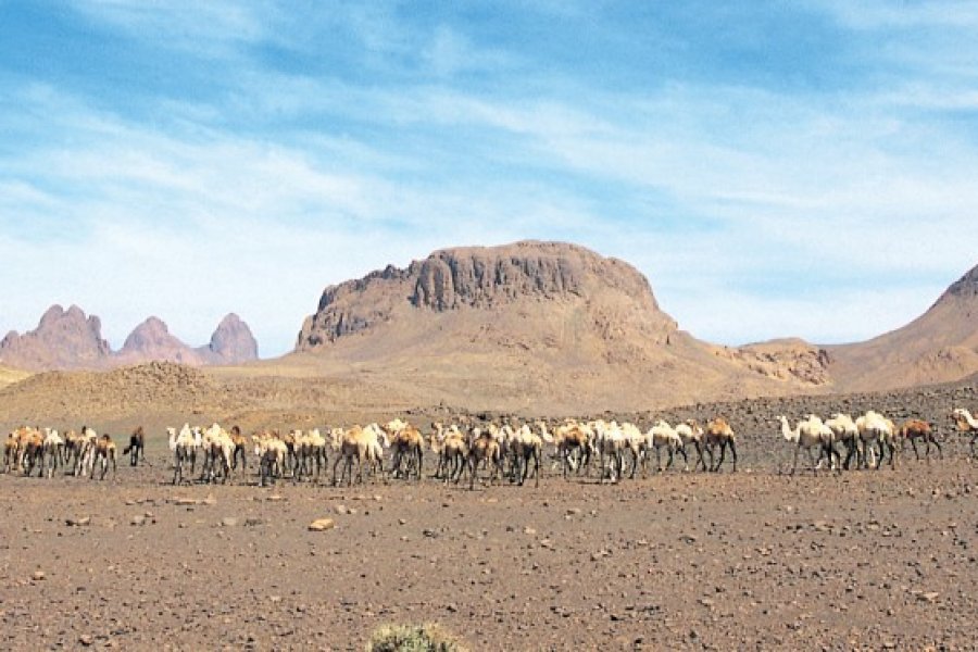
" You cannot see it without thinking of God. We're alone with him. Charles de Foucauld, the guardian of this veritable forest of peaks and needles, carved by wind, heat and cold, and intense shadows.About 80 km northeast of Tamanrasset, the Assekrem is a kind of plateau that dominates the Massif massif, offering a fabulous balcony on what is the attraction of the Hoggar, its chaos, its desolation and its mystical evoke power.Two routes are possible to get there. The most convenient track (about 180 km go and return by Mount Ilamane) and also the most beautiful if one leaves Tamanrasset just before sunrise is the one that passes through the Pic peak, remains of an old volcanic explosion. It takes a half day of ascent and two days to make the most of this grandiose site. After the superimposed gueltas of Imlaoulaoulène (see «Area of Tamanrasset»), we move towards the Pic peak Pic, the Massif massif in which we can observe cave engravings and a Neolithic tomb and Mount Akar-Akar (2 132 m) whose shape dominates a landscape of volcanic origin with evocative shapes. From this beautiful mountain called castle of Antinéa because of its resemblance with a dungeon and at the foot of which is buried Akar, a issebeten chef, the walk makes a little detour by the Gueltas Afilal always surrounded by vegetation and famous for the fish plumber that one finds it (barbeau). After the ritual break, the track climbs strong towards the summit of the Assekrem. If it rained a lot in the previous days - this happens! -it may be impossible to follow this path, but if the track dried and has been cleared, the approaches of the cervix cover a verdure of small flowers of a yellow or purple still intense.After 4 to 5 hours, the hermitage of the père de Foucauld is finally reached. At the highest point of the Massif massif, at 2 725 m above sea level, the priest had built a small house where he planned to retire during the summer months, in a framework conducive to meditation and encounters with the Tuareg (see next page). But if only a few months ago, and if the hermitage has been restored several times, the priest's presence is still very strong. Every morning, at dawn, a mass is celebrated in the sober small dry stone chapel collected on the ground and its spartan room appears to have been left in the morning. Below the winds-beaten chapel, the brothers Alain, Edouard and Ventura are home to the brothers Alain, Edouard and Ventura. An asphalt road leads to the Météorologique meteorological station, part of a global network of about stations.It is advisable to spend the night up there, in the refuge managed by Tim Missaw (see "Agencies" in Tamanrasset, 1 200 DA, breakfast and dinner included) to enjoy the extraordinary light that baigne the Atakor at bedtime and sunrise. The less sporty will have a good 100 minutes to climb the m of difference between the refuge and the hermitage and access, without missing the magic moment, at the best point of view on the Atakor that one can imagine! But beware, the evenings are very cool in winter, do not forget your polar and your good sleeping bag. The accommodation is very rustic but the tasty meals taken in the warm common room and the solar show make them the best souvenirs.After one night at the refuge of the Assekrem, you can descend, abruptly, to the west passing through the vast circus surrounding the Pic peak (2 740 m) whose shape recalls that of the Ihaghen. Then we cross Terhenanet, a village of shepherds surrounded by gardens, before joining the RN 1 by Outoul. This first route in loop bypasses the massif dominated by Mount Tahat (2 918 m), the highest peak of Hoggar and Algeria. At his feet, you can see several burial and cave engravings.Another route, longer, allows to discover the northern slopes of the massif. From the Col de l'Assekrem, you have to go back a little bit further and descend to the left and the Cratère crater and the yaw of Col Tin Teratimt. Some kilometres further, the Gueltas Issakarassene are a set of basins that follow over several kilometres (engravings on the surrounding rocks). At the level of the Zerzoua Oued and des d, take a break on a plateau from where the viewpoint on the Atakor and the Tefedest is unique. At the crossroads between the Piste trail and the road of Idelès and Djanet, Hirafok is a village renowned for its numerous cave engravings. You reach Tamanrasset by the west, via In-Amguel on the RN 1 (190 km).A third route, less frequented, avoids the Assekrem by bypassing it in the east. The runway begins about kilometres south of Tamanrasset, followed by Nlp Nlp N and Fouguegi en at the bottom of Mount Debnat.One hundred kilometres from Tam, one can make a detour through a waterfall (when there is water) that falls into a huge basin. Just after Aokassit, a track leads to a historic site. The French troops, led by Henri Laperrine, had elected Tarhaouhaout to build the Fort Motylinsky in 1910 and make it the capital of the region. The fort is in ruins but the memory of General Laperrine, friend of the father of Foucauld, died in 1920 in an airplane accident on the border of Mali, and his men still haunts the scene.The east slope then passes through Tazrouk, a village in the bottom of a green valley, before becoming frankly hazardous from the climbing slopes to the Col pass. The landscape becomes tragic and spectacular to Tazrouk, an isolated village that leaves the Hoggar harsh harsh. Located on the edge of a Oued, Tazrouk, one of the oldest aghrem (village), is known for its gardens stretching over kilometres and for its annual holiday that lasts three days early August. From Tazrouk, we descend directly to Ideles, a village of blacksmiths (maâlmine), on the Tamanrasset-Djanet track, avoiding the Teberber Oued.
Suggested addresses Assekrem
Weather at the moment
Advertising
Organize your trip with our partners Assekrem
Transportation
Book your plane tickets
Car Rental
Boat rental
Accommodation & stays
Find a hotel
Holiday rental
Find your campsite
Tailor-made trip
Immersion travel
Services / On site
Activities & visits
Find a doctor