An archipelago of islands
The Republic of Fiji is an archipelago state in the South Pacific Ocean, comprising over 300 islands (only 100 of which are inhabited) and 540 islets or atolls. The Fiji Islands - located between the southern Equator and the northern Tropic of Capricorn - cover a total area of around 18,000 km², but are scattered over a large maritime area.
The island of Koro gave its name to the Koro Sea, which lies at the center of the Fiji Islands. Due to coral reefs, shoals and offshore rocks, navigation in the Koro Sea can be risky.
Geology. The Fiji Islands are the result of a complex geological process, and are predominantly volcanic in origin, with rocks often formed in a marine environment. Fiji was historically on the edge of two tectonic plates: the Australian Plate and the Pacific Plate, and the angle of movement of these plates evolved over time to form a small plate called the Fijian Plate. Volcanoes are no longer active in Fiji, but there can be frequent earthquakes due to the movement of the tectonic plates.
Reefs. The islands are also surrounded by numerous coral reefs, which are a delight for marine life and, incidentally, for divers. On the other hand, these coral reefs sometimes make swimming a little more complicated, especially on the Coral Coast (between Sigatoka and Suva).
Administratively, the Republic of Fiji is made up of four regions: the Western Region, the Central Region, the Eastern Region and the Northern Region (corresponding mainly to the island of Vanua Levu). The island of Rotuma is not part of this division and has a separate administrative treatment.
A variety of landscapes
The main island - Viti Levu - covers an area of around 10,000 km², almost half the total surface area of the Fiji Islands. The main towns on Viti Levu are Suva (the capital based in the south-west of the island), Lautoka and Nadi (the latter two being located in the north-west of the island). The majority of Fiji's population is concentrated on the island of Viti Levu.
The highest point on the island of Viti Levu is Tomanivi (formerly known as Mount Victoria), part of the mountain range that crosses the island from north to south. Tomanivi is 1,324 meters high, and several other peaks in the range exceed 900 meters. Several rivers (the Rewa River, Navua River, Sigatoka River and Ba River) run through the island, all rising in the central mountainous zone.
The mountainous areas are followed by plains and plateaus. The coastal plains in the west, north-west and south-east are the preferred areas for agriculture and habitation, although they account for less than a fifth of the island's surface area.
The Mamanucas and Yasawas islands. The island of Viti Levu is also the gateway to the Mamanucas and Yawasas archipelagos, both located to the north-west of Viti Levu, the Mamanucas archipelago being the closest to Viti Levu. It takes just 30 minutes by boat to reach the first island of the Mamanucas, while it takes around 5 hours by boat to reach the most remote island of the Yasawas. Resorts often offer helicopter transfers, which are much quicker. Both archipelagos attract large numbers of tourists for their luxurious resorts, tropical landscapes and wide range of water sports. The volcanic character of the islands is particularly evident in these two archipelagos.
The second main island is Vanua Levu (5,550 km²), located northeast of Vitu Levu. Vanua Levu's main towns are Labasa and Savusavu. The island is also criss-crossed by a mountain range. Apart from the two main towns, the island is sparsely urbanized, even wild in some areas. Natewa Bay is a famous bay for exploring the seabed.
The Somosomo Strait links the island of Taveuni to Vanua Levu. It is renowned for its soft corals and Rainbow Reef, recognized as one of the most beautiful dive sites in the South Pacific.
Taveuni Island is known for the variety of its landscapes, earning it the nickname "Garden Island". Taveuni airport is located to the north at Matei. Matei is not really a town, with resorts and restaurants lining both sides of the road. Taveuni's main town is Somosomo (the Naqara district to be precise). In the south of the island, the village of Vuna is also very small and overlooks Vuna Lagoon, renowned for diving and snorkeling.
Fiji's other islands, which are much less inhabited and represent a relatively small land area, include Kadavu (south of Viti Levu), the Lomaiviti archipelago (off Suva) and the Lau archipelago (in the Koro Sea). Rotuma is the furthest north, geographically speaking.
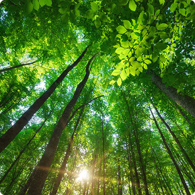
Tropical forests are omnipresent in Fiji, and everywhere you look you'll be overwhelmed by the different shades of green. The Sigatoka Sand Dunes National Park on the Coral Coast of Viti Levu, the Colo-i-Suva Forest Reserve near the capital Suva, the Koroyanitu National Heritage Park near Lautoka and the Bouma National Heritage Park on the island of Taveuni are also worth a visit. In these parks, you can enjoy lush green landscapes, waterfalls, natural pools, hiking trails and, more generally, sumptuous natural panoramas.
Fiji'snatural resources include gold, copper, timber, fishing and hydroelectricity. Sugar production, mineral extraction, logging and fishing are also important sources of revenue.