A region of mountains
Norditalia (Northern Italy), also called Alta Italia or Italia settentrionale, says it all about its alpine nature! It's as if the Alps peg the peninsula to the continent. These high mountains, in their arched shape, crown the boot, from the Po plain to the Ligurian coast, from the Gulf of Genoa to Friuli. Some of the Italian mountains offer spectacular high altitude panoramas. The undisputed star, Monte Bianco, is the highest in Western Europe. Its name comes from its white peaks in all seasons. These eternal snows are regularly measured by surveyors in order to "model the ice cap" and feed an accurate data bank. Glaciologists tell us that Mont Blanc is shrinking... In 2011, it peaked at 4,810.44 m high, in 2016 at 4,808.73 m, and finally, in 2021, at 4,807.81 m. Global warming would not be responsible for this notable oscillation. Depending on the altitude winds, snowfall and precipitation plan the surface of the huge snowdrift of Mont Blanc. What does not change is the size of the rocky summit: 4,792 m.
With its morphology similar to that of the mother mountain, Monte Bianco di Courmayeur (4,765 m) is considered a derivative of Mont Blanc since both are part of the same massif. A solitary peak, the second highest transalpine summit is declared an integral part of Italian territory. However, a disagreement persists between the French-Italian authorities about these 20 hectares, neither quite in France nor quite in Italy, which pass through a ridge line at the top of Mont Blanc and tip over to the south-southeast slope, delimited by the Col Major and Monte Bianco di Courmayeur. The maps of the Conseil national de l'information géographique (IGN) mention this small disputed area as belonging to France. The Italian maps are also without appeal, the Monte is Italian, with the municipality of Courmayeur at its feet! An interpretation more historical than geographical. The French route was inspired by the Treaty of Paris (1746), which handed over Savoy to France. The Sardinian Kingdom had then accepted that the border pass through the "most advanced points of Piedmont". The Italians, on the other hand, base themselves on the Treaty of Turin (1861) which positioned the summit on the border, but on their side... and when you fly over the eternal snows of the Monte Rosa massif (4,634 m), you can see that they are located on the right side of the Swiss border But its base is shared with Italy, which named it after the pinkish tones it takes on at sunset. Although it is also shared with Switzerland, theGrenzgipfel (4,618 m) is the highest Italian peak on Monte Rosa. The Punta Nordend (4,609 m) is the next highest, and is difficult to climb, but offers experienced mountaineers a magnificent view of the Swiss-Italian territory. The Zumstein (4,563 m) is named after one of the mountaineers who were on the original exploratory expeditions in 1820. The name of Punta Gnifetti (4,554 m) pays homage to Father Gnifetti, a pioneer on the peak. Today it attracts many tourists because its ascent is the least difficult and the Regina Margherita refuge, the highest in Europe, awaits them.
The pyramidal peak Cervino, or Matterhorn in German (4,478 m), is located on the Italian-Swiss border. Depending on the watershed, it can be reached either from the Valtournenche valley (Italy) or from the Zermatt valley (Switzerland). On the south side of the Monte Rosa massif, the Punta Parrot peak (4,432 m) is named after a mountaineering doctor who tried in vain to reach its summit in 1800. In the Valle d'Aosta region, the Corno Nero (4,322 m), the Naso del Lyskamm (4,272 m) and the Gran Paradiso (4,061 m) are also part of the Italian "club of over 4,000 m".
This part of the Alps is crossed by large valleys of glacial origin, such as Piedmont, Valle d'Aosta or the Adige Valley. Far from being an impassable obstacle, they are provided with valleys and passes that constitute important communication axes. The mountains expand eastward, until they exceed 150 km in Trentino and Alto Adige, above Verona and Brescia. There, they are overtaken by the so-called pre-Alpine massifs, such as the mythical Dolomites (highest peak: 3,332 m).
The Po Plain, a major physical environment in Northern Italy
The dense hydrographic network, to which is added the water of numerous glaciers, makes the Alps the first water reservoir of the peninsula and in particular of the Po plain. The river is omnipresent in the landscape, from its source at Pian Del Re, in the municipality of Crissolo, in the Piedmontese Alps, to its outlet on the Adriatic Sea. It is the largest Italian river. It is 652 km long and covers a distance of more than five degrees of longitude. It receives the waters flowing north from the Apennines and all those flowing south from the Alps. It follows a tortuous path until it meets the Adige, one of the small coastal rivers which, after following a parallel path, enters the Adriatic Sea through a separate estuary. The Po eventually flows into the sea through a wide delta that has remained marshy for a long time. Before that, the Ticino and the Adda, its main tributaries, help it drain a huge network of valleys and lowlands to which it gave its name.
On nearly 50,000 km², the Po Valley is surrounded by the Alpine arc to the north and the first foothills of the Tuscan Apennines to the south. The plain is almost perfectly flat, with only a few irregularities in the Veneto and Montferrat regions of Piedmont. The Po Valley is the main agricultural and economic region of the country. Cultivated fields lined with hedges of trees (poplars, willows), irrigation or drainage canals, traditional or ultramodern farms, all form the landscape. It is also the region of the great Italian lakes and the great hydraulic installations, which suffered so much from the drought in 2022.
Fed by mountain streams, these lakes represent for Northern Italy a formidable water reserve, a preserved ecosystem, and an invaluable natural and tourist treasure. Four of them belong to Piedmont, the lakes of Orta (18.2 km2), Viverone (6 km2), Mergozzo (1.85 km2), Candia (1.35 km2), and nine are administered by Lombardy, Lake Maggiore (212 km2) varese (15 km2), Idro (11 km2), Garda (370 km2), Como (146 km2), Pusiano (5 km2), Annone (5 km2), Iseo (65.3 km2) and finally Lake Lugano (48.7 km2), shared with Switzerland.
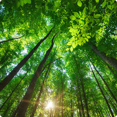
Well protected national and natural parks
To date, Italy has 24 national parks, 146 regional parks, 402 regional and 147 national reserves, 52 wetlands and 30 marine protected areas. In all, 12% of the Italian territory is covered by protected areas, all natural environments being concerned, the Alps, the Lake District, coastal and volcanic areas and even peri-urban areas! In addition, there are geo-parks, museums and dedicated reception centers where visitors can obtain information and prepare their itineraries with or without a guide.
In Northern Italy, the first parks date back to the 1920s, with the creation of the Gran Paradiso National Park and the Abruzzo National Park. There are now 10 national parks in the region. In Piedmont, there is the Val Grande National Park, known for its wild mountain landscapes, and the Gran Paradiso National Park (Valle d'Aosta), which is the first of the Italian national parks and has mountains at an altitude of more than 4,000 meters. In Lombardy, there is the Stelvio National Park, the largest of the Italian historical parks, straddling Trentino Alto Adige. In Veneto, the Dolomites of Belluno National Park was founded in 1993 to preserve this unique alpine landscape. In Liguria, the small but mythical Cinque Terre National Park is very picturesque with its villages clinging to the mountainside and plunging into the Mediterranean. In Emilia-Romagna and Tuscany, the Tuscan-Emilian Apennines National Park unfolds its miles of mountains, forests and lakes. The National Park of the Casentinesi Forests is proud of its forests, the best preserved in Italy, while the National Park of the Tuscan Archipelago spreads its 7 islands in the Tyrrhenian Sea. Finally, in Umbria and Marche, closing the northern march, are the National Park of the Sibylline Mountains and the National Park of Gran Sasso and Monti della Laga, straddling Lazio and Abruzzo.
The Ministry of Agriculture also manages nearly 100,000 hectares of forest. In addition to the state's concern for preserving Italy's natural heritage, there is also environmental activism. The international organization WWF, the best known, co-manages nature reserves(oasi) designed to educate the public and especially children. The landscape observatory, Legambiente, measures and alerts public opinion to coastal erosion. Ultima Generazione, the latest of these activist groups, is a radical environmental movement in Milan that practices non-violent civil disobedience and demands an end to the exploitation of fossil fuels (gas, oil).
Italy's attitude towards environmental protection is therefore more active than one might think. The growing development ofagriturismo (green tourism), i.e. the opening up of tourism to farms and agricultural areas, is one of the most striking expressions of this.
To consult, the online portal on Italian national and natural parks, with a lot of information on the conditions of visits, the weather, the marked itineraries, the contacts of guides, the list of tourist accommodations recommended by the management bodies of the various protected areas: www.parks.it