In the land of blue and green gold: abundant but threatened natural resources
Paraguay is crossed by large hydrographic basins that constitute an abundant water resource. The Guaraní aquifer is one of the largest reserves of fresh groundwater in the world. Covering an area of more than 1.2 million km², it contains a volume of water of approximately 55,000 km3. The snag is that this reserve straddles four countries, Brazil, Argentina, Paraguay and Uruguay, which are unable to achieve concerted management of the resource, despite the signing of an agreement in 2010. The aim was to set up a responsible and systemic management of the aquifer, in order to protect it from pollution that could occur upstream and thus avoid contamination of the downstream environment (mercury from Bolivian mining operations, carried by the Pilcomayo River, or Brazilian glyphosate from agriculture, transported by the Paraguayan river). Successive governments in different countries do not seem to pay much attention to this agreement. Water in river basins is also overexploited. The water of the Plata basin is mainly used for the cultivation of maize, soya and wheat, but also for energy production. The Itaipu hydroelectric power station, commissioned in 1984 on the border between Paraguay and Brazil, is the one that produces the largest cumulative amount of energy in the world. Its construction and operation have not been without a heavy social and environmental cost: displacement of populations, flooding of forests and farmland, submergence of the Seven Falls waterfall... The Pantanal is the largest wetland in the world. This vast alluvial plain, which is largely located in Brazil, but also in Bolivia and Paraguay, is home to the greatest diversity of aquatic plants in the world and the highest density of wild animals in South America. The Paraguayan part of this natural area is threatened by the Hidrovia aqueduct project, whose purpose is to facilitate navigation and provide a maritime outlet for Bolivia and Paraguay.
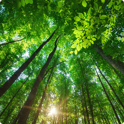
Threats to forests and biodiversity
The forest, another of the country's resources, is sold to large farmers, mainly for cattle grazing, and the cultivation of soybeans - GMOs and treated with pesticides. These crops are used to feed cattle, in situ... but also in Europe. Trees are true carbon sinks, but they also represent a biodiversity - including many endemic species - that is often irretrievably disappearing. Indigenous peoples, who have lived for thousands of years in harmony in these environments, are also being hunted. The situation is particularly dramatic in the Chaco region, which has long been spared. More broadly, the country's natural spaces and resources are threatened mainly by the development choices being made in all the watersheds of the area: intensive agriculture and livestock farming, hydroelectricity and mining, which are leading to deforestation, soil erosion, pollution with pesticides and heavy metals, and poaching. The paradox of a country rich in resources, but without proper management, is that almost a quarter of the population has no access to clean water for consumption. According to the NGO Survival International, in 2014, licences to exploit the forest, the Ayoreo's ancestral home, were granted by the Ministry of the Environment to a Brazilian livestock company, without respect either for the indigenous populations or for the area's classification as a UNESCO biosphere reserve. In August 2019, nearly 37,000 hectares were ravaged by fire. The fire affected the Cerrado, the Pantanal and the Paraguayan Chaco, affecting protected areas including the Río Negro National Park, the Tres Gigantes Reserve and part of the Cerro Chovoreca monument.
National parks and protected areas
The country still has some biodiversity sanctuaries. The national parks will delight nature lovers and lovers of wide open spaces, rather adventurous, as these areas offer little or no tourist infrastructure and are located in rather remote areas. The Chaco thus has several national parks, protecting the characteristic environments and species of the region.
The Teniente Agripino Enciso National Park, created in 1980, shelters in its forests thorny pumas and tapirs, but also varieties of cacti and bromeliads.
TheDefensores del Chaco National Park, created in 1975, is the largest in area. It preserves the biodiversity present in its dry forests, cacti, but also jaguars, pumas, tapirs and armadillos.
The Tinfunqué National Park, established in 1966, shelters within its RAMSAR classified wetland migratory birds, wild ducks, storks, but also sloth.
The Río Negro National Park, also a RAMSAR site, protects part of the Pantanal and its ecosystems: marshes and forests with a great diversity of flora and fauna.
The eastern part of the country, more populated and more touristic, allows the visit of several national parks, some of which are more accessible and often more frequented. These include the following:
Cerro Cora National Park, north of Concepción. Located on the border with Brazil, the site was also the site of a battle that ended the Triple Alliance War in 1870.
Ybycui National Park, located only two and a half hours by car from Asuncion, will allow the traveller to discover the subtropical rainforest ecosystems and its magnificent waterfalls.
Vapor Cué National Park is a historic site dedicated to the conservation of the warships used during the Triple Alliance War.
The San Rafael Reserve, little frequented, is nevertheless home to an exceptional biodiversity. It is also part of the Mbyá Guarani territory.
The less adventurous traveller will however be able to discover private reserves, bringing both better environmental regulations and better facilities for welcoming visitors. Theseinclude the Mbaracayú Biosphere Reserve, managed by the Fundación Moisés Bertoni, and the Itaipú Ecological Reserves.