Between sea and desert
Sea and desert - that's how you could sum up Bahrain's geography in two words. This archipelago of thirty-three islands lies 28 kilometers east of Saudi Arabia, and some 20 kilometers north of Qatar, in the heart of the Persian Gulf. The island of Bahrain covers 83% of the country's total surface area. It is divided into three governorates. The highly urbanized Northern Governorate is home to the capital, Manama. It is home to the country's main palm groves and numerous small residential towns. The southern governorate is home to Riffa, where the King resides. The southernmost tip of the country is desert and, strictly speaking, uninhabited: only the derricks of oil drilling rigs protrude from the landscape. In the heart of the desert lies the country's highest point, Jabal ad Dukhan, 134 metres above sea level. To the northeast of Manama, separated by an arm of the sea, lies Muharraq, the Kingdom's second-largest island and its last governorate. Once the capital, Muharraq has retained a more traditional charm than its neighbor Manama. The country's airport is located here.
Conquering the sea
Following the massive urbanization of the north of the country, and the high density of Manama, the Kingdom embarked on a vast plan to conquer land by the sea. It is estimated that 10% of the country's total surface area is made up of artificial land. Bahrain has developed several artificial island projects, designed to accommodate luxurious residential areas. First came the Amwaj Islands, north of Muharraq, where construction began in the early 2000s. Today, the development of these artificial islands is well underway, and they are already home to high-end hotels and residences. The proximity of the Amwaj Islands to the capital and the airport has attracted many investors in search of peace and quiet. But the most successful project to date is undoubtedly the Bahrain Bay land reclamation project, north of Manama. With its skyscrapers, international financial center and two motorway bridges connecting it to the city center, Bahrain Bay is intended to be the Kingdom's new showcase. As for Durrat Al Bahrain, in the very south of the country, it remains the archipelago's most ambitious artificial island project. Comprising fifteen atolls (five of them fish-shaped), Durrat Al Bahrain is home to hundreds of ultra-luxury villas with private pools and direct access to the beach, as well as all the modern amenities: restaurants, supermarkets, leisure facilities and more. But it's also the project that's seen the most delays: several of the islands are still deserted, and this pharaonic real estate complex sometimes seems quite empty.
A string of deserted islands
The other islands in the archipelago are almost all uninhabited; for the most part, they consist of nothing more than rocks or flush sandbanks. Others are much larger, such as the Hawar Islands, 19 km south of Bahrain, close to the Qatari border. The Hawar Islands are the subject of territorial disputes between Qatar and Bahrain, even though they are completely deserted, with only a royal palace, a police station and a hotel. Nevertheless, they are home to a rich fauna and many migratory birds, depending on the season. The island of Umm an Nasan, located between Saudi Arabia and the island of Bahrain, is the exclusive property of the king. Transformed into a nature reserve by monarch Hamad bin Isa Al Khalifa, it is unfortunately closed to the public. North of Umm an Nasan, Jidda Island, the country's former penal colony, is owned by Prime Minister Prince Khalifa bin Salman Al Khalifa. It too is off-limits to the public. To the south of Muharraq lies Sitra, an island reserved for industrial activities, and a few kilometers off the coast, the island of Al Dar, intended for tourists. All these islands make up a rich and diverse territory, enhanced by the turquoise waters of the surrounding sea. The surrounding sea is simply called the Gulf of Bahrain. Its magnificent color is explained by the absence of a deep seabed, with depths rarely exceeding 20 meters.
A hydrocarbon-rich subsoil
Bahrain may have few natural resources on the surface, but its subsoil harbors the real wealth that has shaped its modern history: oil. In 1932, the archipelago became the first Gulf country to discover the raw material that would shape the region's history, at the Jabal ad Dukhan site. Its name, which means "mountain of smoke", refers to the mists of heat that rise from this desert region. Around the site, derricks still stretch for several kilometers.
But today, one of the kingdom's main assets is its offshore reserves, located in the Gulf of Bahrain. The most important of these is Abu Safah, an offshore field to the west of the archipelago, whose production is shared with Saudi Arabia. This offshore field provides a significant share of the country's exploited oil and illustrates Bahrain's dependence on its powerful neighbor. More recently, in 2018, the country announced the discovery of the offshore Khaleej Al Bahrain field, off the west coast. This field, located in shallow waters, could contain one of the region's largest oil and gas reserves. But the country's subsoil offers more than just oil. It also contains natural gas, which plays a key role in its economy. Most of this hydrocarbon comes from deposits under the Gulf's continental shelf, which the Kingdom continues to explore for new resources.
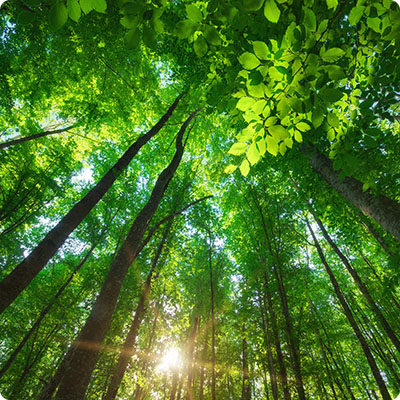
Despite its investments in hydrocarbons, Bahrain's reserves are dwindling year after year. So the country's authorities are seeking to develop an economy that is less dependent on oil and gas. The main sector concerned is tourism. And to attract travellers from all over the world, the Kingdom can capitalize on its geographical assets: wild deserts, pristine beaches and turquoise waters!