Lake Malawi, an inland sea
The ancient Lake Nyassa ("nyassa" means "lake" in the local fishermen's language), 580 km long and 30 to 80 km wide, is the third-largest African lake and the ninth-largest freshwater lake in the world. It spans the territories of Malawi, Tanzania and Mozambique, forming a natural border. Much more than a huge body of water, it's a veritable inland sea covering 30,000 km² (about the size of Belgium) and encompassing 20% of the country's surface area, including lakes Malombe to the south, Chilwa to the southeast and Chiuta to the north. One of the characteristics of Lake Malawi is the exceptional richness of its aquatic fauna, which is of universal importance for the preservation of biodiversity. The diversity of its populations of cichlids - multicolored fish, most of which are endemic to the lake - is remarkable: over a thousand different species have been recorded, half of which are found only here. There are also crabs, jellyfish and freshwater sponges. Set in a deep crevasse in the western Rift Valley, it is also one of the deepest lakes in the world. For 90% of its length, the bottom is 100 metres deep. Lake Malawi's clear waters, with exceptional visibility of up to 20 metres underwater, and deep depths of up to 750 metres, offer divers an unforgettable experience. The average water temperature varies between 24°C and 29°C. It is surrounded by rocky coasts, sandy beaches, wooded hills, lagoons and marshes. Rivers flowing north and east into Lake Chilwa. Rivers flowing west and south empty into the Shire River at the southern end of Lake Malawi. The Shire River, the country's main waterway, is 400 kilometers long and rises in the aforementioned lake, following its course through the Lower Shire Valley, flowing first into Lake Malombe, which then empties into the Zambezi River in Mozambique, which in turn flows into the Indian Ocean. The Likoma Islands (8 km long and 3 km wide) and Chizumulu (3 km2), located to the northeast of the lake, are enclosed within Mozambique's territorial waters and belong to Malawi.
Plains and high plateaus
Malawi is not only rich in the water of its immense lake. Three-quarters of the country is made up of high plateaus, offering superb contrasting landscapes in a wide variety of sub-regions, alternating lakes, rolling plains, arid chasms and high plateaus - all geographical wonders due to the Great Rift, an immense geographical fault that crosses the country from north to south.
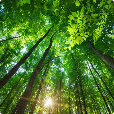
To the east and west, the Great Rift is dominated by vast, high plateaus rising from 900 to 1,200 m above sea level. The northern and central plateaus, rising to 2,000 m, dominate Lake Malawi and end in an escarpment that falls directly into the lake or overlooks a coastal plain, such as the high plateaus of Viphya and Nyika National Park (Malawi's largest park at 3,134 km2). These wide-open grasslands are covered with rainforest, green hills and a huge variety of wildflowers, including 200 different species of orchid that bloom during the summer months (October-April). The name "Nyika" means "where the water comes from", as it is one of the country's largest sources of water, thanks to a generally favourable rainfall. The Nyika plateau, situated 2,000 metres above sea level, culminates at 2,605 m at Nganda peak. Most of the time, this peak is surrounded by clouds. In both the wet and hot seasons, it is shrouded in a dense fog that dissipates only episodically. The scenery is different from the rest of Malawi, with spectacular views of the changing horizon. Its high altitude promises pleasant year-round temperatures for hikers, in contrast to the stifling heat of the valley. The vegetation of Nyika National Park has always attracted numerous species of birds, antelopes, zebras and occasionally panthers, lions and elephants.
In the center of the country, the mountainous Dedza region, southeast of Lilongwe, is home to Central Africa's most important rock painting site. They are listed as a UNESCO World Heritage Site. Between Lake Malombe to the north and Lake Chilwa, Liwonde National Park is a protected area of dry forest and savannah. Crossed by the Shire River, a tributary of the Zambezi, it is home to a large population of large mammals.
The Shire Highlands are located on the eastern flank of the Great Rift Valley, east of the Shire River. Covering an area of 7,250 km2, their altitude ranges from 600 m to 1,200 m. They form an arc to the west and south of the Lake Chilwa basin and the Phalombe plain.
In the south of the country, the high plateaus are dominated by the Zomba Mountains and the Mulanje massif, with the Sapitwa peak reaching 2,130 m and 3,002 m respectively. It lies to the east of Blantyre, not far from the border with Mozambique. It is the country's highest point and one of the highest peaks in Southern Africa.
Isolated, Mount Mulanje is often shrouded in white clouds that cling to its flanks and give a glimpse of its highest peaks, earning it the nickname "island in the sky" from the locals. It rises proudly, forming an angular break with the gentle lines of the tea fields. In the local Chichewa language, sapitwa means "don't go there". Although the area is popular with hikers, it is notoriously dangerous due to sudden weather changes, sudden drops in temperature or violent rainfalls, resulting in a lack of visibility for visitors wishing to hike the massif. There are, however, numerous trails suitable for both experienced hikers and beginners. Towards the west, the land slopes gently down towards Zambia. The southernmost part of the country, with Lengwe National Park, is a lowland plain.