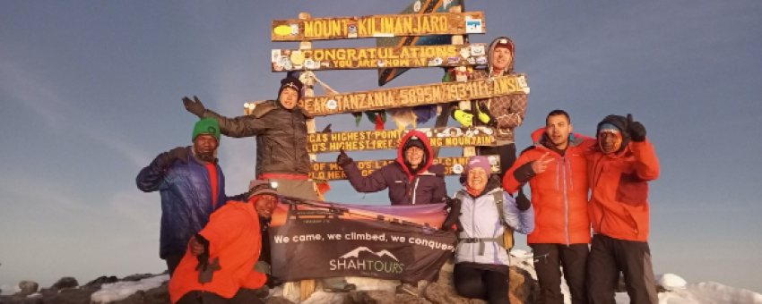
8-DAY GROUP TOUR OF LEMOSHO ROUTE KILIMANJARO 30TH OCTOBER TO 08TH NOVEMBER 2025
Join our international group departures to Tanzania and experience the adventure of a lifetime! Whether you want to conquer the peaks of Kilimanjaro or Mount Meru, or immerse yourself in the breathtaking wildlife of our safaris, we've got you covered.
Why choose us?
Smaller groups: Enjoy a personalized experience with a favorable guide/client ratio, ensuring you receive the attention and support you need on every trek.
Guaranteed departures: Most of our group tours are guaranteed to depart, even if you're the only one to have booked. Your adventure is always on!
Flexible options: Combine several experiences - climbing, trekking and safari - for extra savings, or choose your adventure as a stand-alone package. The choice is yours!
Book now and take part in an unforgettable trip to Tanzania. Adventure awaits!
Highlights of the trip
During your stay you can enjoy the following highlights: Faune and flora, Adventure / Sports & Leisure, Off the beaten track, Nature travel, Travelling alone and travelling in a group.
Best months to go
The best time(s) to go is/are : Janvier, Juin, Juillet, Août, Septembre, Octobre, Novembre, Décembre.
How to get there?
You can get there by Plane.
SHAH TOURS
From 2580€ à 3000€ / person
Travel suitable for :
Detail of the stay : 8-DAY GROUP TOUR OF LEMOSHO ROUTE KILIMANJARO 30TH OCTOBER TO 08TH NOVEMBER 2025 - 8 days
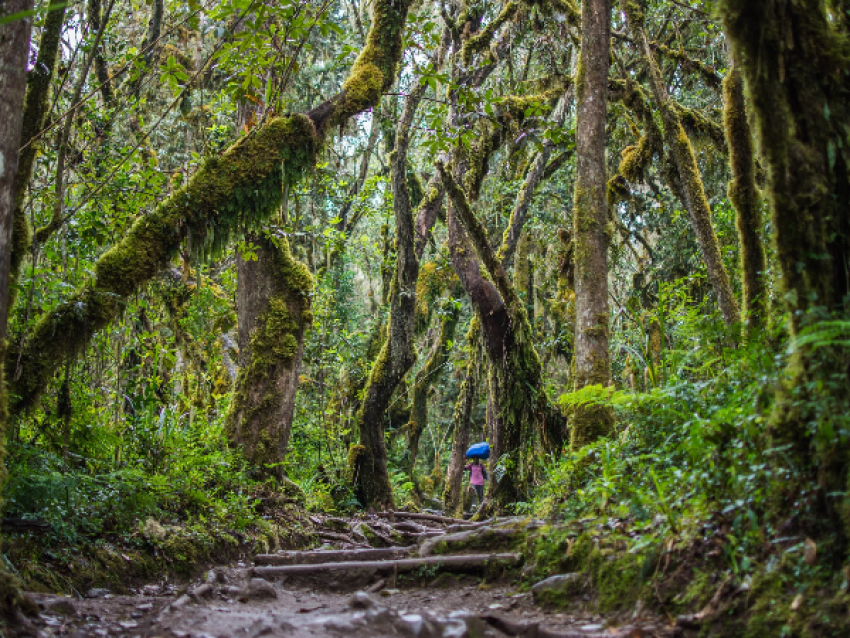
LEMOSHO GATE TO MTI MKUBWA (BIG TREE) CAMP
© SHAH TOURS
Steps: Moshi
You will be transferred by road from Moshi (09:00) to Lemosho Gate. After check-in, you continue on the 4x4 track to the trailhead where you begin your trek through the rainforest area with your guide. The forest is thick and diverse with flora and fauna, and there's a chance of rain this afternoon, which is common in this area, making the trail slightly slippery. A short, winding trail will gradually lead you to the first camp.
Approximate distance by car: 2-3 hours
Approximate trekking time: 3-4 hours
Approximate trekking distance: 7km / 4.5mi
Starting altitude: 2100m or 6890ft
Final altitude: 2780m or 9120ft
Highest altitude reached: 2780m or 9120ft
Altitude gain / loss: +680m or +2230ft
Meals included: Breakfast, picnic lunch, dinner
BIG TREE (MTI MKUBWA) CAMP TO SHIRA ONE CAMP
© SHAH TOURS
This morning, you quickly leave the forest zone along a steep path, as the dense vegetation slowly fades to give way to heather and moorland. The rest of the day is devoted to a steady hike up the Shira ridge, from where you can see Shira Peak (the third of Kilimanjaro's volcanic cones), which offers a spectacular, jagged landscape of this eroded peak.
Approximate distance by car: None
Approximate trekking time: 4-5 hours
Approximate trekking distance: 7km / 4.5mi
Starting altitude: 2780m or 9120ft
Final altitude: 3505m or 11500ft
Highest altitude reached: 3505m or 11500ft
Altitude gain / loss: +725m or +2380ft
Meals included: Breakfast, picnic lunch or lunch, dinner
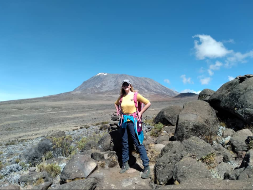
SHIRA ONE CAMP TO SHIRA CATHEDRAL PEAK TO SHIRA TWO CAMP
© SHAH TOURS
Today's hike takes you gradually across the Shira plateau, through heather and moorland, with an optional extra hike to Shira Cathedral Peak (3880 m), before gradually leading you to Shira Two camp. Shira is the third of Kilimanjaro's volcanic cones and has been shaped by lava and volcanic activity to create a stunning jagged peak and offer a unique western view of Kibo, the highest of the peaks and your final destination.
Approximate driving distance: 0 hours
Approximate trekking time: 3-5 hours
Approximate trekking distance: 6km / 4mi
Starting altitude: 3505m or 11500ft
Final altitude: 3845m or 12615ft
Highest altitude reached: 3872m or 12705ft
Altitude gain / loss: +340m or +1115ft / -27m or -90ft
Meals included: Breakfast, picnic lunch or lunch, dinner
SHIRA TWO CAMP TO BARRANCO CAMP
© SHAH TOURS
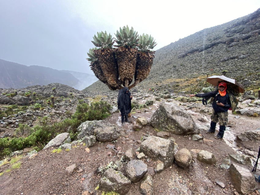
Your hike today takes you towards to Kibo cone steadily climbing up and over the edges of the alpine desert to your first high altitude at the lava tower (4630m or 15190ft). Today helps you to acclimatize and also is a great indicator to see how your body can handle the higher altitude. From the Lava Tower you begin your steep descent anti clockwise around Kibo and into the Barranco Valley passing the large flowering mountain cacti (Kilimanjaro Senecios) unique to Kilimanjaro. The day ends around the same elevation as you started on the edge of the heather and moorland.
Approx. driving distance: None
Approx. trekking distance: 10km or 6mi (6-8 hours)
Start altitude: 3845m or 12615ft
End altitude: 3960m or 12990ft
Highest altitude reached: 4630m or 15190ft
Altitude +gain / -loss: +785m or +2575ft / -670m or -2200ft
Meals included today: Breakfast, picnic lunch or lunch, dinner
Overnight: Barranco campsite, 3960m or 12990ft
BARRANCO CAMP TO KARANGA CAMP
© SHAH TOURS
This morning you will leave the camp and ascend the Barranco wall. This is an impressive non-technical scramble and gives a feeling of mountain climbing (without any previous experience or advanced equipment required) and is rewarded with a superb view from the top back into the camp and the Heim glacier on the peak. The remainder of the hike will be through the alpine desert slowly winding around the mountain till the Karanga valley which you descend into and again up till your camp. Karanga valley is the last water point.
Approx. driving distance: None
Approx. trekking distance: 6km or 4mi (3-5 hours)
Start altitude: 3960m or 12990ft
End altitude: 4040m or 13255ft
Highest altitude reached: 4250m or 13945ft
Altitude +gain / -loss: +290m or +955ft / -210m or -690ft
Meals included today: Breakfast, picnic lunch or lunch, dinner
Overnight: Karanga campsite, 4040m or 13255ft
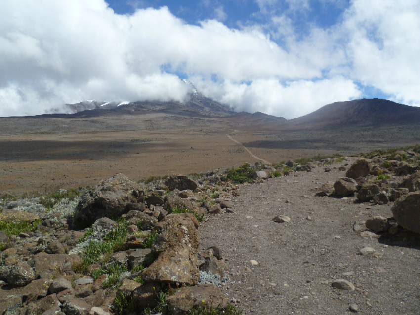
KARANGA CAMP TO BARAFU CAMP

© SHAH TOURS
Today you climb almost casually through the empty landscape of the alpine desert where you keep a slow pace even though the path is not extremely steep. Kibo cone starts to near and you may finally glimpse the Mawenzi peak (Kilimanjaro's second peak) in the east. The short distance means you have plenty of time at your summit camp to rest and prepare for the summit attempt tonight.
Approx. driving distance: None
Approx. trekking distance: 4km or 2.5mi (3-4 hours)
Start altitude: 4040m or 13255ft
End altitude: 4640m or 15225ft
Highest Altitude reached: 4640m or 15225ft
Altitude +gain / -loss: +600m or +1970ft
Meals included today: Breakfast, picnic lunch or lunch, dinner
Overnight: Barafu campsite, 4640m or 15225ft
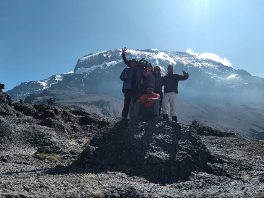
BARAFU CAMP TO STELLA POINT TO UHURU PEAK TO MWEKA CAMP
© SHAHE TOURS
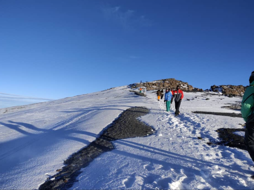
In the early morning (around 00:00am) you begin your final ascent to the summit of Uhuru peak through the arctic zone. The trek is a steep hike over loose volcanic scree through the dark and cold night and takes a slow pace in a zig-zag pattern towards Stella point (5685m or 18650ft) which is your first stop on the Kibo crater rim. From here a short (but difficult) hike remains to take you to Uhuru Peak (5895m or 19341ft), the highest point in Africa. You usually don't spend that long at the peak due to the extreme altitude and will descend back down to the base camp for your breakfast / brunch. After your gear is packed up you continue the descent through the alpine desert, heather and moorland and eventually stopping at Mweka camp in the rain forest zone for a well-deserved rest.
Approx. driving distance: None
Approx. trekking distance: 19km or 12mi (14-18 hours)
Start altitude: 4640m or 15225ft
End altitude: 3700m or 12220ft
Highest altitude reached: 5895m or 19431ft (Peak!)
Altitude +gain / -loss: +1255m or +4206ft / -2195m or -7211ft
Meals included today: Midnight snack, brunch, picnic lunch or lunch, dinner
Overnight: Mweka campsite, 3080m or 10105ft
MWEKA CAMP TO MWEKA GATE TO MOSHI TOWN

© SHAH TOURS
Your final day on Kilimanjaro is a descent through the southern rain forest until Mweka gate where our vehicle will be waiting to take you back to Moshi town. Usually, the crew will leave you at Mweka gate and it's a perfect opportunity to say goodbye to your crew who all generally head directly home from the end gate.
Approx. driving distance: 1 hour (to Moshi) / 2 hours (to Arusha)
Approx. trekking distance: 10km or 6mi (3-4 hours)
Start altitude: 3700m or 12220ft
End altitude: 1630m or 5350ft
Highest altitude reached: 3080m or 10105ft
Altitude +gain / -loss: -1450 or -4755ft
Meals included today: Breakfast*
* We do not include lunch on the last day when descending via Mweka as we expect most to descend before lunch time. It is common for many to celebrate with their guides for this lunch just outside of the park or you can have your lunch at your post climb lodge instead.
Overnight: Optional (see add-ons below)