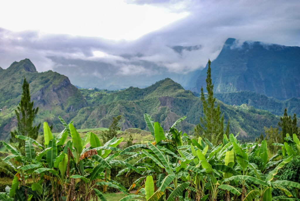
With its lush vegetation and volcanic relief, there's no shortage of beautiful walks on Réunion Island. The island is a true paradise for walkers, with no fewer than 900 km of footpaths!
1. The GR®R3, tour of the Mafate cirque
- Distance: 37 km
- Difference in altitude: 3,800 m
- Duration: 4 to 5 days
- Itinerary
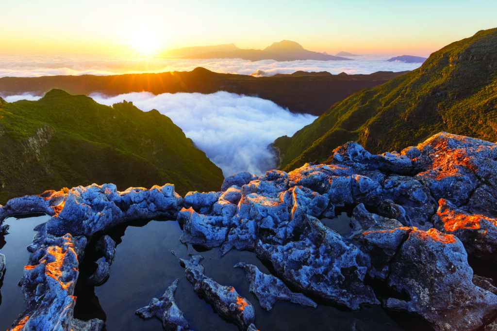
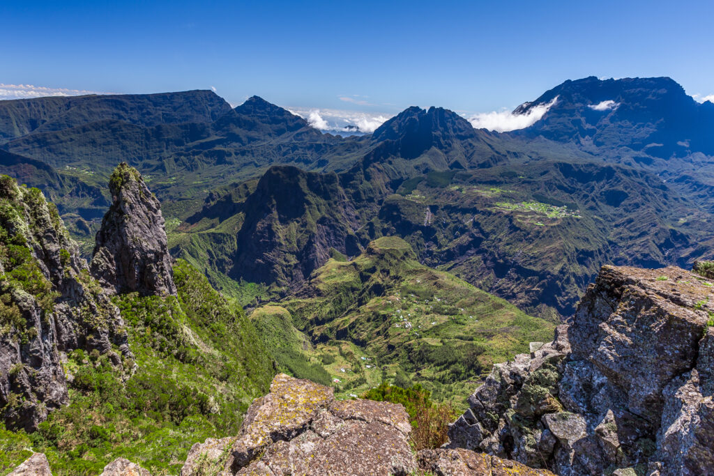
The Cirque de Mafate is the only cirque on Reunion Island that is not accessible by road, but only on foot or by helicopter. Particularly isolated and unspoilt, it has amply earned its title as one of Réunion's most beautiful hikes. As one of theisland's must-sees, it offers absolutely spectacular views over this steep valley inhabited by just 700 people. It's well worth the effort, however, as this challenging hike will require several days' walking and a significant altitude difference.
2. The GR® R2, Réunion Island's longest crossing
- Distance: 135 km
- Difference in altitude : 10 125
- Duration : 10 to 15 days
- Itinerary
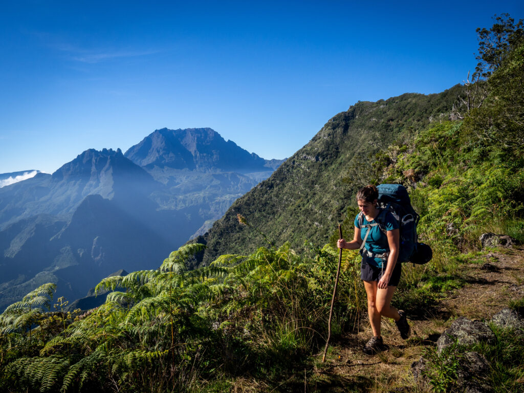
Beginners abstain! The GR® R2 is one of the most difficult hikes in France, and as such one of the most legendary ! In addition to its daunting altitude difference and distance, the long crossing of Réunion Island should be avoided in wet weather, otherwise it could become a dangerous hike. As its name suggests, this trail crosses Réunion from Saint-Denis in the north to Basse Vallée in the south, via the Piton des Neiges and Piton de la Fournaise. For thrill-seekers, however, it's well worth the effort, as the GR® R2 allows you to discover the island like never before, admiring sublime landscapes and stopping off for stages in authentic, isolated villages.
3. The Piton de la Fournaise
- Distance: 12.5 km
- Difference in altitude : 550 m
- Duration : 5 hrs 30 mins
- Itinerary
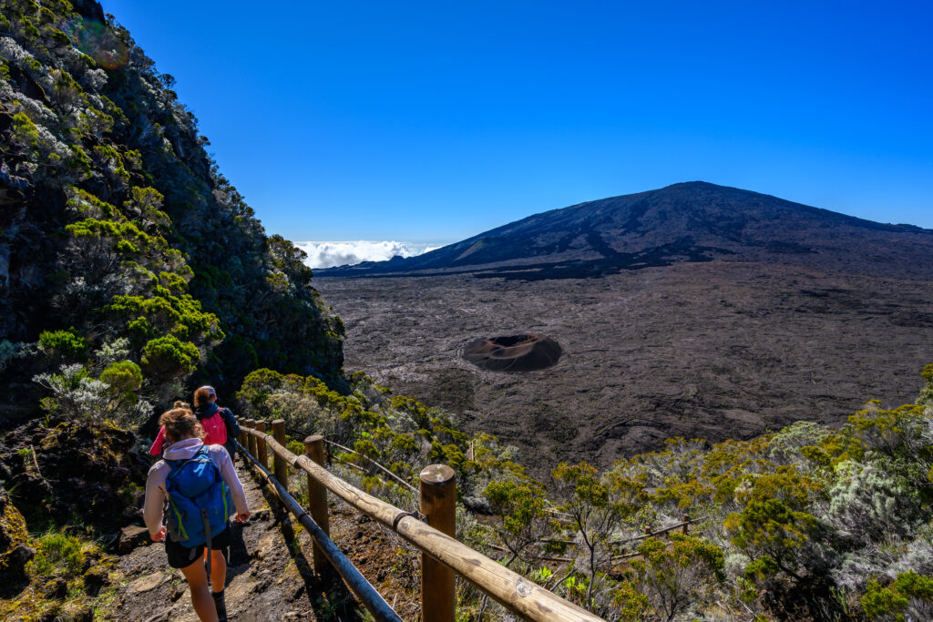
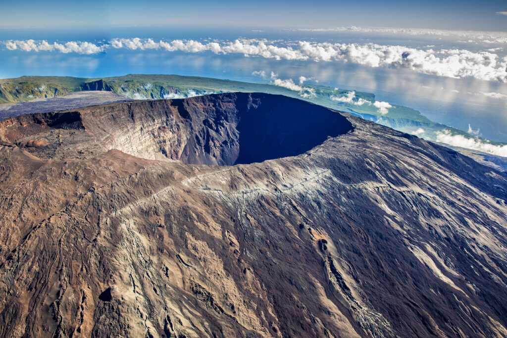
This beautiful hike on Reunion Island allows you to conquer the mythical Piton de la Fournaise, the island's only remaining active volcano. Rising to an altitude of 2,632 m, it still erupts and billows smoke. At the summit, you'll catch a glimpse of the Dolomieu crater, before taking the same path back down. Because of the altitude and the smoke, the weather can be very changeable, and quickly foggy. So make sure you have suitable clothing and good walking shoes, as the trail can be rough. This challenging hike is for experienced walkers only.
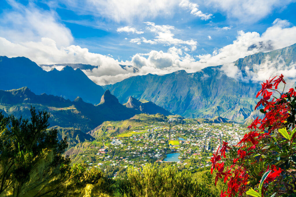
4. The Salazie cirque: the bride's veil falls
- Distance: 2.5 km
- Difference in altitude: 100 m
- Walkingtime : 1 h
- Itinerary
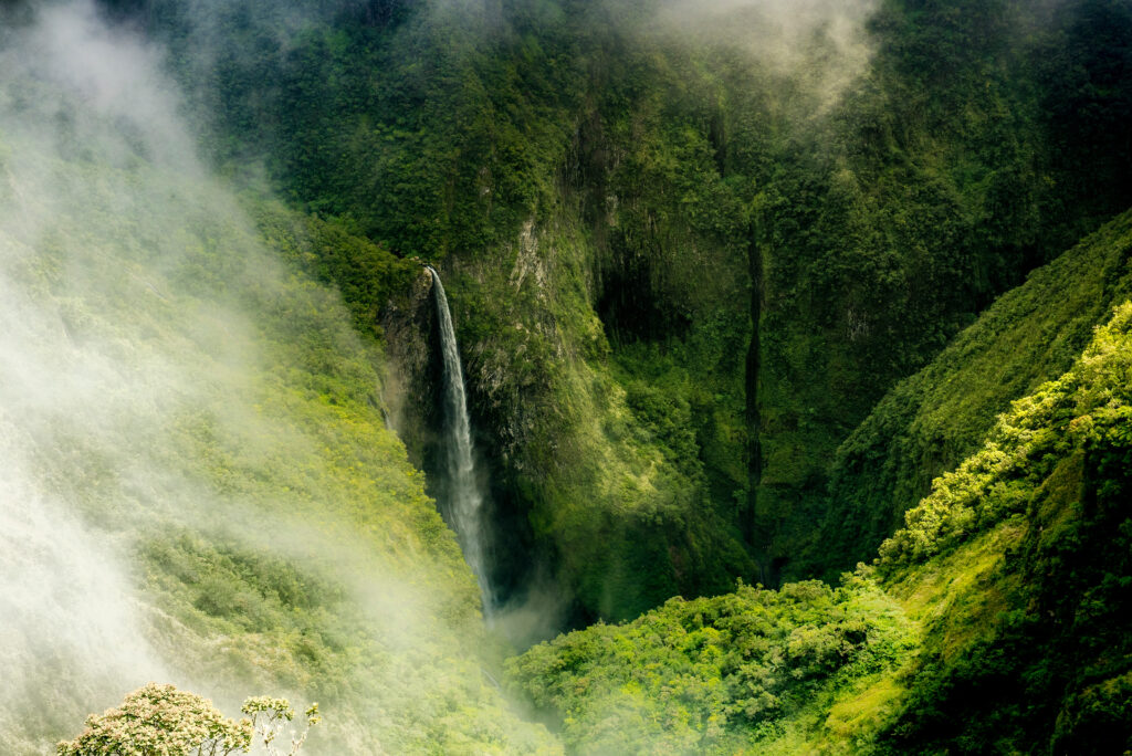
This easy trail is accessible even to the less athletic, thanks to its short distance and moderate gradient. But it's still a mountain hike, so you need to be careful and well-equipped, as the stony path can be particularly slippery. This tour takes in the heart of the Cirque de Salazie, one of the three spectacular collapses of the Piton des Neiges, making it one of Réunion's most beautiful hikes. The itinerary also allows you to discover a superb site that's a must on your Reunion Island itinerary : the Voile de la Mariée waterfall, one of the most beautiful on the island. Along the way, you'll even walk across a lovely suspension bridge over the Rivière du Mât.
5. The Piton des Neiges
- Distance: 14.5 km
- Ascent: 1,730 m
- Duration: 1 to two days
- Itinerary
Climb the highest peak in the Indian Ocean: the Piton des Neiges! Peaking at 3,070 m, its conquest must be earned, as this beautiful Réunion Island hike is of a very difficult level. So don't consider undertaking it if you're not a very experienced hiker. What's more, you'll need to equip yourself accordingly, and hike in clear weather, lest the slippery ground prove dangerous. Even so, your efforts will be worth the reward, as the view from the summit is breathtaking, especially if you opt for a night ascent, so as to admire the sunrise from the Piton des Neiges. The round-trip hike can be completed in one day, taking around 9 h 30, or in two days. In the latter case, you can spend the night at the gîte de la caverne Dufour.
6. The sentier des sources, cirque de Cilaos
- Distance: 4.8 km
- Difference in altitude: 220 m
- Duration : 1 h 45 min
- Itinerary
This easy hike allows you to appreciate Réunion's peaks, even as a beginner or with the whole family. It's a loop, mainly in forest, and therefore offers the big advantage of being almost entirely in the shade, which can be rare with the island's volcanic landscapes. The other advantage: this hike is fairly short, with a relatively moderate ascent of 220 m. As well as taking in the scenery of the cirque de Cilaos, in the heart of the piton des neiges, you can admire the coteau Kerveguen, a magnificent rock rampart.
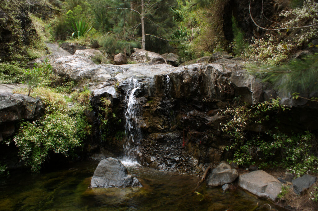
7. Bras Rouge waterfall, cirque de Cialos
- Distance: 6.5 km
- Difference in altitude: 356 m
- Duration: 2 hrs 30 mins
- Itinerary
This medium-level trail is ideal for families, as there are no rugged sections. It follows the route of the GR® R2, which is very well maintained by the Fédération Française de Randonnée. It's the perfect compromise for those who want to try out the Grande Randonnée route, without having to hike for several days. This is one of Réunion Island's finest hikes, and like the previous one, it lies at the heart of the cirque de Cialos. It leads to the pretty Bras Rouge cascade, a vertiginous rock waterfall. Continuing a little further, you can take an invigorating swim at the Bassin des Roches, to reward yourself before setting off again along the same route for the return journey.
8. Le Maïdo at La Glacière
- Distance: 11.4 km
- Difference in altitude : 400 m
- Time : 3 hrs 30 mins
- Itinerary
Less famous than some of its cousins, the Maïdo is nonetheless a superb peak offering this beautiful Réunion Island hike. This trail departs from Le Maïdo on a medium-level out-and-back route. Some even choose to set off from the peak at sunrise, to take in the marvellous view before starting the hike. This hike is suitable for families or beginners, but will still require some effort on the ascent. You'll then reach the Glacière, a curiosity of the island: an excavation once dug by man into the rock to obtain and store ice.
9. La Roche Écrite from Mamode Camp
- Distance: 9.5 km
- Ascent: 1,075 m
- Duration :
- Itinerary
This trail offers a variety of interesting landscapes, including rainforest, with superb lush vegetation. Be sure to bring good shoes, as the trail is quite muddy in places, especially at the start, especially as this hike has a steep gradient and is therefore of a difficult level. It starts with the ascent of La Roche Écrite, one of Réunion's highest peaks at 2,276 m above sea level. This is one of Réunion Island's most beautiful mountain hikes. On a clear day, the Roche Écrite offers an unobstructed view of the island's rugged landscapes, including several cirques, such as Mafate, which it dominates.
10. Le Trou de Fer via Bélouve
- Distance: 9 km
- Difference in altitude : 250 m
- Duration : 2 h 45
- Itinerary
This medium-level trail is relatively short, with a low gradient, bearing in mind that it is a panoramic hike. Indeed, this beautiful Réunion Island hike sets out to discover the Trou de Fer, accessing a natural terrace offering a magnificent view of this natural wonder. This superb chasm forms a gaping hole 300 m deep, into which several waterfalls cascade, forming what is undoubtedly one of the island's most spectacular landscapes. It can only be reached by hikes, the most popular of which is this one through the Bélouve primary forest. This is an ideal activity for a trip in November or December, at the start of the dry season, to ensure that you have a clear view of the Trou de Fer on arrival, but that the waterfalls are still well supplied with water.
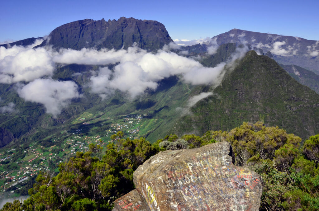
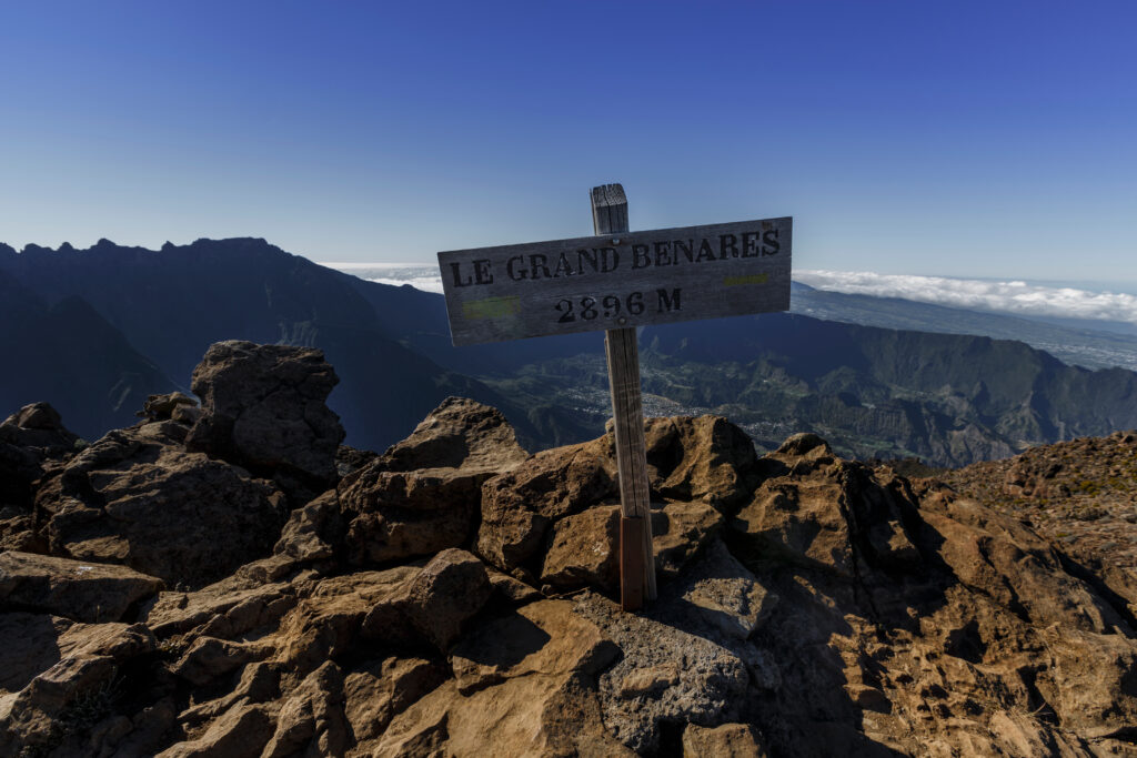
11. Le Grand Bénare via Le Maïdo
- Distance: 17.4
- Difference in altitude : 930 m
- Time : 6 h 30
- Itinerary
This itinerary partly follows the one described above for the Maïdo, this time forming a difficult loop. This trail has a significant vertical drop of almost 1,000 m, and requires you to cover a considerable distance. The Grand Bénare, the island's third-highest peak, has to be earned!


