Travel Guide Nouakchott
Find an accommodation
Advertising
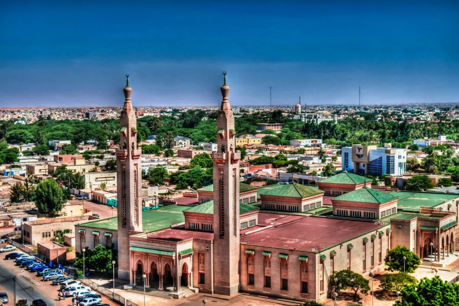
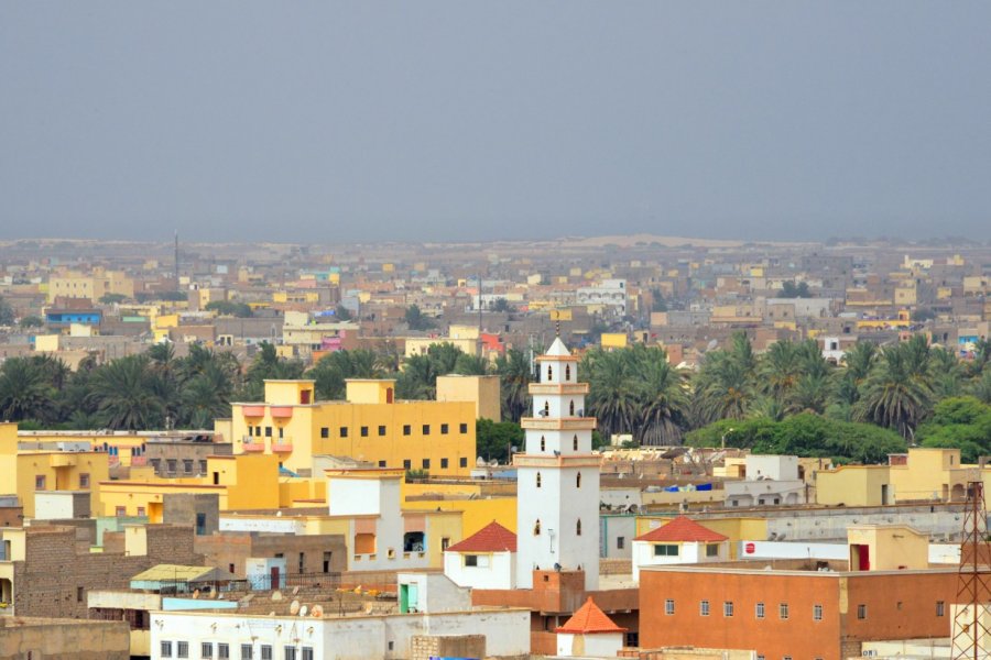
It was President Mokhtar Ould Daddah who chose, on July 24, 1957, to turn into a capital of Mauritania what was only a village at the time. Why choose such a site, where there was no palm grove, as seat of the administrations of the new state? A number of reasons, both political and geographical, led to this decision.At all times, Mauritania, or what would become so, was torn between its Arab-Berber and Negro-African populations, passing through the domination of each other in order to achieve the status quo today. Geographically, Nouakchott had the advantage, although located in Moorish territory, of being very close to the black populations of the Senegal River region. This choice was crucial for the eternal tension between the two peoples to soothe without extinguishing. For a time planned to become the capital, Atar and Nouadhibou were located too far north while Rosso, also a candidate, was too south.On the climate front, the favorable location was estimated, although the site of the future capital found itself in two meters of water during the exceptional rains of 1950. It is true that the ocean influence makes the high temperatures bearable and in Nouakchott, in the evening, the sea breeze even brings a welcome freshness.On March 5, 1958, the first stone of Nouakchott was officially posed. The origin of the name of the capital of Mauritania was certainly explained by the shell of shellfish that the ocean, when it covered the region, left behind. A researcher, Mokhtar Ould Hamidoun, points out that Nouakchott means etymologically, «the place where, when one digs a well, water appears at a level where the shells are abundant.» " "Galloping DemographyThe population of the capital has grown from 5,000 inhabitants at its inception to nearly one million today, exploding the forecasts. This galling demography was caused by droughts in the years 1973-1974. Nomadic breeders, whose herds had been decimated, and sedentary farmers, whose land had become sterile, fled the bush to find refuge in Nouakchott. This influx of people has brought its usual lot of problems. The capital supply of the capital, first assured by wells and then by tanks, is now apparently resolved. Since 1964, Nouakchott has been connected to a vast fossil water table with a surface of 180 km 2 located about thirty meters deep, and 60 kilometers east of Nouakchott, Idîni. The water is supplied with pipes and is at present the needs of the inhabitants of the capital. On the other hand, uncertainty remains about the potential for renewing this fossil table, causing Nouakchott a dangerous uncertainty. That is why serious projects are studying the feasibility of building infrastructure to desalinate seawater.The people of Nouakchott are young, they come to practice trade or any other activity, even if unemployment is important. You can get treatment, go to school and enjoy electricity, random bush things.The city is structured, and lodges, fed by water and electricity, slowly but surely replace «spontaneous habitats», in other words slums. The authorities allocate parcels of land on the outskirts of the capital to new arrivals. Nouakchott grows on the edge of the tar, northeast along the water pipeline and southwest to the port. In 40 years, the urban population in Mauritania has risen from 5% to more than 60%. Almost one in three Mauritanians lives in Nouakchott.
What to visit Nouakchott?


Advertising
Suggested addresses Nouakchott
x 46
The best restaurants
x 41
The best hotels
x 15
The best visits
x 19
Travel agencies
x 59
The best transportation
x 13
The best outings
x 4
Sport and leisure activities
x 10
The best treats
x 2
The best care
x 5
The best stores
x 2
The best home-deco
x 19
The best services
x 2
The best events
x 16
The good plans
Weather at the moment
Weather all year round
Advertising
Organize your trip with our partners Nouakchott
Transportation
Book your plane tickets
Car Rental
Boat rental
Accommodation & stays
Find a hotel
Holiday rental
Find your campsite
Tailor-made trip
Immersion travel
Services / On site
Activities & visits
Find a doctor
Nouakchott travel inspiration

Find unique Stay Offers with our Partners


Other destinations nearby Nouakchott
5 km away