Travel Guide Parc National De Peneda-Gerês
Find an accommodation
Advertising
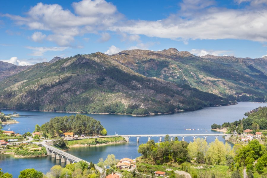
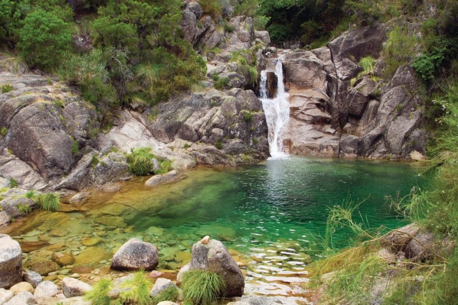
In the shape of a horseshoe, the only national park in Portugal (since 1971) covers an area of nearly 70,000 hectares between the plateau of Castro Laboreiro (1,335 meters) to the north and that of Mourela (1,380 meters) to the east. The Serra da Peneda, the Serra do Soajo, the Serra Amarela and the Serra do Gerês, a massif of Monte Gerês culminating at 1,556 meters above sea level, follow one another. It is a real Portuguese "little Switzerland". Nearby, Ponte da Barca is a charming little town that looks like a miniature version of Ponte de Lima. Its name, da Barca, comes from the ferry used to carry passengers across the Rio. On Wednesdays, the town comes alive with the market. It is also a good place to go to discover the Peneda-Gerês Park. In this mountainous area, Gerês is a very good option to discover the natural park. The village of Rio Caldo, located at the southern entrance of the park, can be used as a base for hikes and excursions in the nature reserve. Nearby, a lake will help to cool down in summer. Melgaço, in the north of the national park, close to the Spanish border on the N202, is a medieval town with a castle accompanied by its graceful Torre de Menagem. Arcos de Valvedez, a large and quiet village overlooking the Rio Vez, is another entry point to the Peneda-Gerês National Park.
What to visit Parc National De Peneda-Gerês?


Suggested addresses Parc National De Peneda-Gerês
Weather at the moment
Advertising
Organize your trip with our partners Parc National De Peneda-Gerês
Transportation
Book your plane tickets
Car Rental
Boat rental
Accommodation & stays
Find a hotel
Holiday rental
Find your campsite
Tailor-made trip
Immersion travel
Services / On site
Activities & visits
Find a doctor