Travel Guide Saint-Lucia
Find an accommodation
Advertising
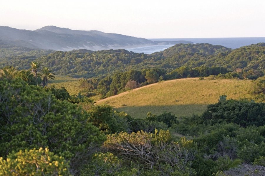
Discovered in a shipwreck in 1575, today Saint Lucia Estuary is a tourist village from which you can explore the entire region. The Greater St Lucia Wetland Park, a World Heritage Site, encompasses the entire coastline, from Mapelane Nature Reserve in the south of the estuary to Sodwana Bay in the north, as well as Lake St Lucia and False Bay. The contours of these 36,000 ha of salt water are quite complex: Lake Saint Lucia is shaped like a butterfly, connected to the ocean by Saint Lucia Estuary to the south and separated from it by the coastal dunes of Cape Vidal. The western wing is called False Bay. Its salinity is three times that of the Indian Ocean. In 1944, the western shore of False Bay was converted into False Bay Park, with direct access from the village of Hluhluwe. The eastern wing, Lake Saint Lucia proper, was declared a nature reserve in 1897. It features three islands: Bird Island, Lane Island and Fanie's Island. The Saint Lucia Marine Reserve extends three nautical miles from the beach, south of Cape Vidal to Ponta do Ouro on the Mozambique border, making it the largest marine reserve in Africa. Turtles come here to breed. If you're lucky enough to be in the area between December and March, it's a magical sight to experience at nightfall, in the company of a guide specializing in turtle protection.
Suggested addresses Saint-Lucia
Weather at the moment
Advertising
Organize your trip with our partners Saint-Lucia
Transportation
Book your plane tickets
Car Rental
Boat rental
Accommodation & stays
Find a hotel
Holiday rental
Find your campsite
Tailor-made trip
Immersion travel
Services / On site
Activities & visits
Find a doctor
Find unique Stay Offers with our Partners


Other destinations nearby Saint-Lucia
100 km away