Travel Guide Gavdos
Find an accommodation
Advertising
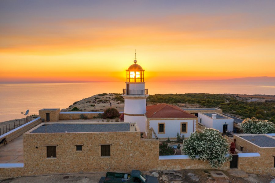
Surface of 30 km² (Gavdopoula 2,5 km²). Located 32 nautical miles southeast of Paleohora (3.5 to 4 hours crossing time), 22 nautical miles south of Hora Sfakion (2.5 hours crossing time), and only 170 nautical miles from the African coast opposite Libya, Gavdos was the southernmost point of the European Union before Cyprus joined the EU-25. A wooden chair of 3 m height sealed at the end of Cape Tripiti facing north symbolizes this. The atmosphere is special on Gavdos. One feels there, more than elsewhere, the proximity of Africa and a direct contact with natural elements untouched by pollution. An important fact to take into account: it is better to leave yourself some margin when you decide to go to Gavdos because you can very easily stay blocked for several days. In short, if for one reason or another you want to disconnect yourself from the surrounding frenzy, Gavdos is the place for you.. The official permanent population of the island is between 50 and 60 inhabitants but it is common that Italian fishermen, passing through in winter for example, are included in the figures. The tourist infrastructure is embryonic: the island has only recently opened up to tourism, in a somewhat anarchic way with temporary constructions with a definitive tendency to be completely illegal. Dependent on the cost of transport for the supply of food and diesel in particular, the inhabitants try as best they can to get by. But the winter months are long, and most of those who remain on the island tend to drown in the psicoudia... From the northeast to the southwest, the relief rises gradually to about 400 m before descending steeply into the Libyan Sea. In the north and east, the landscape is relatively green while in some parts of the island it is almost lunar: the goats and the progressive abandonment of all cultivation cause an irreversible soil erosion. A rare species of juniper (the Phoenician juniper), remarkable for its size, which is found mainly in the northwest of the island, is trying to survive thanks to the European program Natura 2000 which has included Gavdos in its protection program. Karave, the island's port, is located in the east. In fact, just a pier with a kafeneion and some rooms to rent. The capital Kastri looks more like a hamlet and is located in the center of the island. Except for Sarakiniko which has developed in recent years, the other places (Vatsiana, Ambelos and Korfos) look more like half deserted places. In summer, the population increases appreciably with the arrival of the tourists who, for much, practise the wild camping and settle sometimes during several months in shelters of fortune or under the trees near the sea. The others are divided between Sarakiniko and Korfos. The roads are mostly tracks, only a few kilometers are paved, which explains the general state and the dusty appearance of the vehicles. There is a bus that goes from Karave to Agianis via Sarakiniko and only operates during boat arrivals and departures. Otherwise, people who offer rooms can bring you with their vehicles (pick-up, tractor or minibus) for free if you rent a room from them. There is a grocery store in Sarakiniko that also does kafeneion (often out of stock) and another better stocked one before Agianis. But as a general rule, if you choose to stay a few days, buy what you might need in Paleohora or Hora Sfakion. It will be cheaper anyway.
What to visit Gavdos?
Advertising
Suggested addresses Gavdos
Weather at the moment
Advertising
Organize your trip with our partners Gavdos
Transportation
Book your plane tickets
Car Rental
Boat rental
Accommodation & stays
Find a hotel
Holiday rental
Find your campsite
Tailor-made trip
Immersion travel
Services / On site
Activities & visits
Find a doctor


