Travel Guide Khövsgöl Lake National Park
Find an accommodation
Advertising
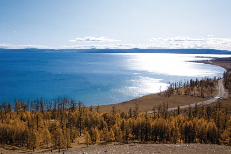
The national park covers an area of 8 381 km ², largely occupied by Lake Khovsgol, the "blue pearl of Mongolia", which alone covers 2 612 km ² and 136 km long. It is also the second largest lake in Mongolia, after Lake Uvs, located at the western end of the country. Its western shore is dominated by the mountain Khoridol Saridag, which rises to 3,000 meters and offers a splendid view of the lake. It is fed by 96 rivers, but only one emerges, the Egiin River, a tributary of the Selenge River, which flows into Lake Baikal. Lake Khövsgöl is the deepest lake in Central Asia, being up to 262 meters deep in some places. However, its very clear waters ensure its transparency and offer an amazing spectacle in winter. Four months a year, it is completely covered with ice. The locals say that people prone to vertigo cannot bear to walk on the frozen lake because the ice is so transparent that one can see up to a hundred meters deep! This once sacred lake is now open for swimming, fishing and sailing. There are many species of fish, and it is also the place of passage of some species of migratory birds from Siberia. Two cities are located on its banks: Khatgal in the south and Khankh in the north. They are connected by a ferry service with random departures and which works only in summer.
Suggested addresses Khövsgöl Lake National Park
Weather at the moment
Advertising
Organize your trip with our partners Khövsgöl Lake National Park
Transportation
Book your plane tickets
Car Rental
Boat rental
Accommodation & stays
Find a hotel
Holiday rental
Find your campsite
Tailor-made trip
Immersion travel
Services / On site
Activities & visits
Find a doctor