VOLCANO LA SOUFRIÈRE

A few facts and figures. Altitude at summit: 1,467 m. Family: Pelean-type stratovolcano (explosive). Character: slowly increasing activity since 1992. Last eruption: 1976 (minor phreatic eruption). Last magmatic eruption: 1530 (formation of the dome). Observation network: nearly 200 measurement sites, including some sixty equipped with autonomous stations (with batteries and solar panels) telemetered by radio transmission to the Observatory.
Description of the hike. Hiking time: 4 hours, rated easy. Elevation gain: 500 m. Guadeloupe boasts over 300 km of hiking trails (called Traces in Guadeloupe), but the climb to La Soufrière is one of the must-do's: visiting an active volcano is something you can't do every day, so you might as well make the most of the opportunity.
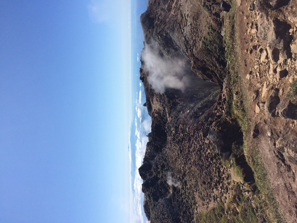
The hike begins at the Pas du Roy, a section paved (in part) by the army in the late 19th century, and takes 40 minutes to reach the Savane-à-Mulets. This fairly steep section leads to the old parking lot (built before the 2004 earthquake) through a humid forest dominated by marbri, better known as bois-bandé. With luck, the view of Les Saintes and the surrounding mountains is already splendid. The hike then continues along a small path at the top of the parking lot, near an interpretation panel. A few metres further on, in a small niche carved into the top of a huge boulder, the statuette of Notre-Dame de Guadeloupe is protected from thieves by a wrought-iron grille. It is not uncommon to see candles and flowers placed as offerings at the foot of the rock. There are flowers all along the way, too: you won't want to miss the mountain thyme with its pretty purple blossoms, or the mountain fuchsia with its pink flowers. Higher up, you'll come across the mountain yellow pineapple, which forms impressive, dense clumps at ground level, and the superb "Christmas tree", which is in fact a primitive fern. After a little more effort, you'll come to a magnificent site: the Faujas rockfall. This is a fault created by a phreatic eruption in 1798. The vegetation here is remarkable, with beautiful vegetated walls that seem to disappear into the sky. A further 15 minutes' walk takes you to the northern fault and the last steep incline before the final ascent, which takes a further 20 minutes. A few meters before the summit, you'll pass by a concrete shelter, useful in case of sudden weather deterioration. If you're lucky, the view from the summit is breathtaking, taking in the whole of Guadeloupe and the neighbouring islands. Before starting the descent, you'll pass through the Porte d'enfer and the Tarissan chasm: 70 m deep, this is the largest active chasm on the summit. It contains a boiling lake of hydrochloric acid!
Once back at the starting point, don't hesitate to take advantage of the yellow baths: the water here averages over 30°C! However, beware of amoebae (micro-organisms that can be pathogenic): don't dive head first into the water.
Respect nature: the entire circuit is located in the heart of the Guadeloupe National Park. If you want everyone to be able to enjoy this exceptional place, please respect the prohibitions: don't go off the trail, respect the signs, don't take shortcuts around bends (they damage the vegetation and lead to landslides), don't pick up anything and don't leave anything behind, not even a banana peel! There are no garbage cans on the trail or even in the parking lot, so take all your garbage with you.
Warning: between 2014 and 2019, new areas of fumaroles appeared at the summit, necessitating an order from the Prefect of Guadeloupe to extend the safety perimeter at the summit of La Soufrière in order to prevent and reduce risks to hikers. Signs have been put up by the National Park: please respect them for your own safety!
To approach the chasms of the "Vieille Dame" dome, you will need to wear a personal respiratory protection device (gas mask) and be accompanied by a qualified guide.
For up-to-the-minute information on the trail: www.guadeloupe-parcnational.fr (Randonner section). The randoguadeloupe.gp website is also very useful. It offers detailed hiking itineraries (difficulty level, itinerary to follow, dynamic cartography, GPS tracks and 3D navigation) and is regularly updated by Park staff, particularly on trail practicability.
Tips for a safe hike: Choose a hike suited to your level of fitness and physical ability. The level of the trails (called traces in Guadeloupe) is indicated, as well as their duration. Find out about the condition of the trails and the weather forecast for the day (rainfall can cause rivers to rise sharply). Always inform a third party of your chosen itinerary, and stick to it. Don't set off after 3pm, as night falls at 6pm at the latest in the tropics. Equip yourself with walking shoes, water, food (dried fruit, energy bars...), a telephone, rain gear...
Further information
Opening time and information on VOLCANO LA SOUFRIÈRE
Reserved for good walkers. Allow about 4 hours. Remember to leave a change of clothes in the car.
Book the Best Activities with Get Your Guide
Members' reviews on VOLCANO LA SOUFRIÈRE