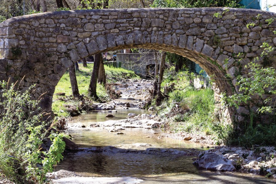
It's likely that Roquefort-les-Pins takes its name from the Castellas castle, erected by the lords of Antibes (Roque designating an edifice built on high ground). Long broken up into hamlets spread over a vast area, the commune has recently been refocused around a new Provencal-style village center, where you'll find housing and shops. The territory is formed by the northern part of the Valbonne plateau, raised by the cliffs of the Gorges du Loup. This environment offers a wealth of walking opportunities: there are seven hiking trails to discover, including the Via Aurelia, one of the routes on the Santiago de Compostela pilgrimage route. A map available from the town hall and media library allows visitors to discover the hidden treasures of Roquefort-les-Pins. Here, a pretty Roman bridge in grey stone, washed by water and years. Further on, the remains of a ruined borie, a well and an old oven. Further still, the remains of the towers of a castle overlooking the river Loup. Ideally located close to the Sophia Antipolis employment zone and the Côte d'Azur, Roquefort-les-Pins is a sought-after holiday destination. The commune has a population of 6,500.A little history. Archaeological digs date the first occupation of the site back to prehistoric times (Péguière cave), then to the Neolithic period (Peyraoutes dolmen). In the 11th century, the lords of Antibes founded the first parish, with Saint-Pierre (San Peyre) church as its place of worship. The medieval period saw sustained human activity, but Roquefort's territory declined in the 14th century, following the Hundred Years' War. It wasn't until the 16th century that the chapel of Canlache was built in the northern part of the present-day commune. Its location, at the crossroads of the roads to Grasse, St-Paul-de-Vence and Antibes, gave it strategic importance, and life developed in this area until the 19th century. In the 16th century, the village saw the arrival of many families expropriated for the fortification of Saint-Paul-de-Vence, who were given plots of land in Roquefort in compensation. The result was a widely dispersed settlement pattern, mainly made up of bastides and farms, grouped together in rural hamlets. Roquefort, which had depended on Saint-Paul, became a commune in its own right in 1790. Waterworks were carried out. The construction in 1884 of another place of worship in today's Colombier district, further south, contributed to a division between the upper and lower parts of Roquefort. It was at the beginning of the 21st century that the public authorities moved into the Plan district, creating an area of convergence and reunification for the various districts of Roquefort-les-Pins.