The Moscow Canal
From the Moscow Canal it will take about 10 hours and 6 locks to reach the Volga Junction. The dream of Peter the Great, the founder of St. Petersburg, came true and the idea of a Moscow-St. Petersburg link was officially inaugurated in 1937. Stalin can now be proud that Moscow has a port connected to the 5 seas. However, the link had been envisaged long before Stalin. As early as 1825, a canal was dug linking Moscow to the Volga in order to transport the materials needed for the construction of the Cathedral of Christ the Savior in Moscow. Alas, after the construction of the Moscow-St. Petersburg railway line, it was abandoned and was blown up on Stalin's orders. From 1930 onwards, Stalin began to rebuild a new one and opted for a straight line. Seven years and 200 millionm3 of excavated soil later, the canal was completed. It required pharaonic developments (dikes, tunnels ...). The human cost is consequent: the construction of the canals signed the death warrant of many prisoners of the Gulag.
From Uglich to Kostroma
Sailing on this stretch means discovering the Golden Ring, along which the grandiose sites of Tsarist Russia can be seen.
Bell tower of the submerged St. Nicholas' church in Kaliazine. A little before arriving in Ouglitch, one will notice the bell tower of Kaliazine, delicately placed on the river. Originally, it is the bell tower of the St. Nicholas Cathedral built in the 1800s on the village square of Kaliazine, built around a monastery founded in the 15th century and known for its rare manuscripts. Stalin razed this monastery to the ground and the construction of the dam will flood the whole area.
Ouglitch. Located on the right bank of the Volga, in a very wooded environment, Ouglitch is one of the jewels of the Golden Ring: the river in its setting. To the right, in the Old Kremlin, you can see the red and white facade and the night-blue bulbs studded with golden stars of the Dimitri-on-the-Sang-Versé church and the green dome of the Cathedral of the Transfiguration. The Church of the Nativity of St. John the Baptist which has a green bulb with scales. In the centre stands the palace of Dimitri.
Myshkin. You will come across this tiny town where it all began with a story... that of a handsome prince sleeping on a summer's day on the banks of the Volga River. After a few hours, his sleep is disturbed by a little mouse running over his face. He wakes up with a start, frightened, not by the presence of the little rodent, but by that of a snake. The mouse, unwittingly, had just saved the life of the great prince! At the place where the miracle took place, the prince ordered his troops to build a cathedral dedicated to the two Russian saints, Boris and Gleb. A city will gradually be established around it, and will be named... Myshkin, capital of mice (mych in Russian), and every year a unique festival is dedicated to them. The city also gave its name to the hero of Dostoyevsky's The Idiot.
At km 425-440, the town of Rybinsk. Its name, "city of fishes", comes from the 12th century, when it was a Slavic fishing centre. If the first contact was very romantic (we can see from the ship the domes of the cathedral), today it is mainly an industrial city, with its shipyards and match factory
At km 512, the Monastery of the Presentation of the Virgin or Tolga Convent on the left bank, in a forest. Founded at the beginning of the 14th century, it consists of two churches whose towers are crowned with grey arrows
Yaroslavl is one of the oldest and most famous cities in Russia with several splendid churches that you can enjoy from the river. It is a place of great interest in the arts and a place where you can take your time to live. The shops, bars and clubs are more welcoming than anywhere else in the country.
Kostroma has kept its 19th century appearance, since today all construction has been banned there. Of the 40 18th century churches, only 10 remain.
Volga-Baltic waterway
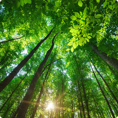
After passing through the Rybinsk lock, you will arrive at the beginning of the Volga-Baltic Canal. With a total length of 360 km, it has proclaimed itself "the longest canal in the world". This is only partly true, as it is made up of as many artificial channels as there are natural watercourses. Officially opened to navigation in 1964 and named Lenin, it allows ships to link the north of the Rybinsk reserve to the south of Lake Ladoga more quickly. Indeed, the old Mariinskaya system required them to use many locks and canals. Forests occupy two thirds of the region. Deciduous trees and conifers give a dark majesty, and what a charm these riverside villages have!
Cherepovets
. Founded in 1777 at the junction of two rivers, it is today an industrial town known above all for its museum dedicated to Vasily Vereshagin (1842-1904), one of the great figures of Russian art.At km 714, the ruins of the beautiful flooded church of Krokhino
mark the entrance to the White Lake.Lake Beloye. In the 17th century, Lake White was considered the fishing ground of the Tsar, who was not really interested in fish, but rather in the taxes he collected from fishermen. It is a real link in the commercial relations between the north and the south of Russia.
From Kiji to Saint Petersburg
The arrival on Kiji is spectacular, because after crossing many islands more or less wooded, the whole thing stands out in the distance. This is one of the highlights of the cruise, as is the passage through the Lower Svir lock which allows entry to Lake Ladoga, the last stop before marvelling at the grandeur of the city of St. Petersburg.
Lake Onega. It has a surface area of 9,900 km² and an average depth of 30 m, which can be as deep as 120 m. This makes it the second largest lake in Europe, after Lake Ladoga, to which the Svir, the only one to emerge from it, connects it. To the north, the landscape consists of almost 1,300 islands, the rocky shores are covered with pine forests. In the south, linden and elm trees take their place along the sandy shores which are covered with reeds. Here we enter the heart of Karelia with its some 60,000 lakes and 25,000 rivers. Here you might meet bears, lynx, elk, foxes and wolves, not to mention the famous wild swans and geese. More than 40 species of fish live in the lake. The water in the lake is of rare purity and would be excellent to taste. The climate of this region is particularly harsh with many storms creating swells of up to 5 m on the lake
Rock carvings on the cliffs to the east of the lake attest to the ancient presence of primitive tribes. And the region was for a long time the main producer of wood. Today it provides 22% of sawn timber and 44% of Russian paper. The timber industry, the largest employer, has led to the creation of dozens of small industrial towns
Petrozavodsk, now the most populous city on the lake, was founded in 1703 by Peter the Great, who set up a cannon foundry there (Petrozavodsk means "Peter's factory"). The best gunsmiths from the Kremlin were brought here to make cannons, pistols and various firearms. In 1798, it became the Tsarist Weights and Measures Factory, before declining due to its isolation
Other examples include Medvezhegorsk, a small industrial town, Pryazhya, 40 km to the south, famous for its comedy festival, and Pudozh, the most exotic, one of the oldest cities in Russia.
Theisland of Kiji offers superb examples of religious and traditional peasant architecture: houses, granaries, barns, windmills. The civil architecture of the north is characterized by the fact that the long and harsh winter imposes the organization of life inside
The Svir. After crossing Lake Onega from north to south, the boat enters the Svir. Although modest in size (224 km), it is a real enchantment for those who cross it. Starting from Lake Onega and flowing into Lake Ladoga, the two largest lakes in Europe, it is known as the "Blue Road" because of its winding meanders, crossing swamps, dense forests and languid villages.
Svirstroy. This small village is located at km 1 087, shortly after the Mondraga and Sara rivers joined the Svir. A stop here allows to discover the stone and wooden houses of the former workers and the local population used to receive tourists.
At km 1 159-1 166, the mouth of the river is 700 m wide. Beyond the banks, this area of 40,000 ha forms a large nature reserve where bears, lynx, elk and many species of birds live.
Lake Ladoga. It is on its icy waters, whose crossing we begin at km 1,366, that the supplies of Leningrad passed through during the German blockade from 1941 to 1944. 1 million St. Petersburgers fled by this route, using ships in summer and trucks in winter. They used ice roads on the frozen lake. Its shores are sometimes steep in the north and west, with long but modest fjords in the north, and sometimes swampy and forested in the southeast. On the south coast there are beautiful sandy beaches. Much less populated than those of Lake Onega, the shores of Lake Ladoga are dotted with small towns with old-fashioned charm: Olonets, Sortavala, and Pitkiaranta, which survive on fishing and the timber industry
The pearl of the lake is unquestionably the Valaam archipelago, covering an area of 36 km², made up of about fifty small islands, the main one, Valaam, is a nature reserve housing one of the most prestigious monasteries of the Russian Orthodox Church. Seven lakes, in the middle of a sumptuous forest, numerous creeks and small paths make this place a haven of peace conducive to meditation. The monastery was founded in 992 by two Greek monks. It has played a very important role over the centuries.
The Neva River originates in Lake Ladoga and flows into the Gulf of Finland where it flows into the Baltic Sea with an impressive estuary (280 km²). With a width of 250 to 1,300 m and rather high banks between 6 and 9 m, its 74 km course is very varied and pleasant. On the other hand, the proximity of the Baltic Sea and its rainy climate do not allow to benefit for sure from the good weather.
The Neva has always been a problem in the relationship between Russians and Swedes. At the very source of the river, opposite the town of Petrokrepost, the Prince of Novgorod decided in 1323 to build a small wooden fortress on the trade route linking Eastern Europe to the Baltic. In 1582, the Swedes tried, in vain, to seize the citadel. Until 1914, the fortress became a prison, the most feared in all Russia
After passing Kivorsk with its hydroelectric power station and flower production atkm 1330-b, we find ourselves at km 1332-b in front of a granite pillar dedicated to the town of Arbuzovo, which was completely destroyed during the Second World War. The ship will surely sound a siren in memory of the Soviet soldiers who lost their lives there.
At km 1 353-1 357-b, a church stands on the very spot where, on 15 July 1240, Alexander Yaroslavich, Prince of Novgorod, defeated the Swedish troops. From that day on he called himself Alexander Nevsky.